Area Overview for E12 9DP
Photos of E12 9DP


Area Information
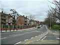
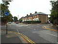
E12 9DP is a small, tightly defined postcode area in east London, home to just over 2,200 residents. It is a compact residential cluster, characterised by a focus on flats rather than detached housing. The area’s demographic profile suggests a mature community, with a median age of 47 and the majority of residents falling within the 30–64 age range. This suggests a population largely composed of working-age adults, many of whom may be professionals or families with children. The presence of multiple primary schools nearby, including Avenue Primary School and Salisbury Primary School, both rated ‘good’ by Ofsted, indicates that E12 9DP is a family-friendly area. Daily life here is likely shaped by proximity to transport hubs, with five rail stations within reach, including Manor Park and Woodgrange Park. Residents benefit from strong broadband connectivity, with a score of 97, ensuring reliable internet access for both work and leisure. While the area lacks natural or protected landscapes, its accessibility to retail, transport, and educational facilities makes it a pragmatic choice for those prioritising convenience over scenic surroundings.
- Area Type
- Postcode
- Area Size
- Not available
- Population
- Not available
- Population Density
- Not available
The property market in E12 9DP is dominated by flats, with home ownership at just 27%. This suggests a rental-oriented market, where the majority of residents are likely to be tenants rather than homeowners. The prevalence of flats, rather than detached or semi-detached homes, points to a housing stock that prioritises density and affordability over spaciousness. For buyers, this dynamic means that the area is unlikely to be a strong market for owner-occupied properties, with limited scope for long-term investment in residential assets. However, the compact nature of the postcode may make it an attractive option for those seeking rental income, particularly given the proximity to transport links and schools. The small size of the area also means that property choices are limited, with buyers needing to consider nearby zones for more varied options. The focus on rental housing reflects broader trends in London’s east, where affordability and accessibility often outweigh the appeal of homeownership.
House Prices in E12 9DP
No properties found in this postcode.
Energy Efficiency in E12 9DP
Residents of E12 9DP enjoy a range of amenities within easy reach. The area is served by five retail outlets, including Tesco Forestgate and Tesco Romford, providing access to everyday shopping needs. For transport, the proximity to rail stations like Manor Park and ferry piers such as East India Pier and North Greenwich Pier adds versatility to commuting and leisure activities. The presence of multiple rail, metro, and bus options ensures that residents can navigate the area and beyond with ease. While the postcode lacks large parks or natural spaces, the availability of ferry access and nearby stations suggests a lifestyle centred on connectivity and convenience. The combination of retail, transport, and educational facilities creates a functional environment, ideal for those prioritising accessibility over expansive green spaces. This mix of amenities supports a practical, urban lifestyle, with minimal need for long-distance travel to meet daily needs.
Amenities
Schools
Residents of E12 9DP have access to several primary schools, including Avenue Primary School and Salisbury Primary School, both of which hold a ‘good’ Ofsted rating. These institutions provide state-funded education options for families, with a focus on primary-level learning. Additional nearby schools include Avenue Infant School and Salisbury Infant School, which cater to younger children. For those seeking independent education, the London Christian Learning Centre is also within reach, offering an alternative to state-run institutions. The presence of multiple primary schools in close proximity suggests that E12 9DP is well-served for families with children, reducing the need for long commutes to education. The mix of state and independent options allows parents to choose between free public schooling and fee-paying alternatives, depending on their priorities. This diversity in educational provision enhances the area’s appeal to families seeking convenience and choice in their children’s schooling.
| Rank | School | Type | Entry gender | Ages |
|---|
Explore more schools in this area
Go to Schools tabDemographics
The population of E12 9DP is 2,256, with a median age of 47, reflecting a community skewed towards adults in their 30s to 60s. The most common age range is 30–64, suggesting a stable, working-age population. Home ownership in the area is low, at just 27%, indicating that the majority of residents are likely to be renters. This aligns with the accommodation type, which is predominantly flats, a format often associated with rental markets. The predominant ethnic group is the Asian community, though specific subgroups are not detailed. This demographic profile suggests a population that may be established in the area, with a focus on practical housing and family needs. The low home ownership rate may also imply a transient element, with residents prioritising flexibility over long-term investment. For those considering E12 9DP, understanding the community’s age profile and housing dynamics is key to assessing whether it aligns with personal or family requirements.
Household Size
Accommodation Type
Tenure
Ethnic Group
Religion
Household Composition
Age
Household Deprivation
NS-SEC
Explore more demographic insights in this area
Go to Demographics tabPlanning
Planning Constraints
- Flood RiskPremium
- Ramsar Wetland SitesPremium
- Area of Outstanding Natural BeautyPremium
- Protected Nature ReservePremium
- Protected WoodlandPremium