Area Overview for E12 9BS
Photos of E12 9BS


Area Information
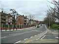
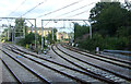
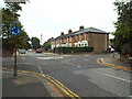
Living in E12 9BS means being part of a small, tightly knit residential cluster in east London. With a population of 1,607, the area is compact but offers practical access to transport networks and retail hubs. The community is primarily composed of adults aged 30–64, reflecting a mature demographic. This postcode is not a sprawling suburb but a focused cluster of homes, many of which are flats. The area’s proximity to rail and metro stations, including Manor Park and Wanstead Park, makes commuting straightforward. Nearby, retail options such as Tesco Forestgate and East Ham provide daily essentials. While the area lacks natural landscapes or protected sites, its connectivity to London City Airport and ferry piers like East India Pier adds to its accessibility. For those seeking a balance between urban convenience and a quieter residential setting, E12 9BS offers a base with clear links to the wider city. However, its small size means the immediate surroundings are key to understanding its character.
- Area Type
- Postcode
- Area Size
- Not available
- Population
- Not available
- Population Density
- Not available
The property market in E12 9BS is characterised by a high proportion of rental properties, with only 24% of homes owned by residents. This suggests the area is more of a rental market than an owner-occupied one, which may affect long-term investment appeal. The accommodation type is predominantly flats, which are common in smaller, densely populated areas. These flats are likely to be older or purpose-built, reflecting the area’s compact footprint. For buyers, this means the immediate surroundings are critical, as the small postcode area offers limited housing stock. The flat-dominated market may appeal to those seeking affordable rental options or short-term stays, but it could limit opportunities for those seeking owner-occupied properties. The area’s proximity to transport hubs and retail centres may offset its lack of expansive housing options, making it attractive for commuters or those prioritising convenience over property type.
House Prices in E12 9BS
No properties found in this postcode.
Energy Efficiency in E12 9BS
Life in E12 9BS is shaped by its proximity to retail and transport hubs. Nearby, Tesco Forestgate and Tesco Romford offer everyday shopping, while the area’s rail and metro stations provide easy access to wider London. The presence of ferry piers, such as North Greenwich Pier, suggests opportunities for leisurely river trips or events, though these are more recreational than daily necessities. The compact nature of the area means amenities are concentrated, requiring residents to plan trips carefully. However, the density of transport options, including five rail stations and multiple metro stops, reduces the need for car ownership. For those seeking a mix of convenience and urban access, E12 9BS provides a base with straightforward links to retail, travel, and the city’s infrastructure. The absence of natural amenities or parks within the postcode itself means nearby green spaces are likely a key consideration for residents.
Amenities
Schools
| Rank | School | Type | Entry gender | Ages |
|---|
Explore more schools in this area
Go to Schools tabDemographics
The population of E12 9BS has a median age of 47, with the majority of residents falling within the 30–64 age range. This suggests a community of working-age adults, likely established in their careers. Home ownership is low at 24%, indicating that most residents rent their homes. The predominant accommodation type is flats, which aligns with the area’s compact nature and likely older housing stock. The predominant ethnic group is the Asian_total category, reflecting a culturally diverse population. This demographic profile shapes the area’s social dynamics, with a focus on family-oriented living and community ties. The low home ownership rate means the area functions more as a rental market than an owner-occupied one, which could influence property values and investment potential. The absence of specific deprivation data means the quality of life is not explicitly quantified, but the presence of amenities and transport links suggests a functional, if modest, living environment.
Household Size
Accommodation Type
Tenure
Ethnic Group
Religion
Household Composition
Age
Household Deprivation
NS-SEC
Explore more demographic insights in this area
Go to Demographics tabPlanning
Planning Constraints
- Flood RiskPremium
- Ramsar Wetland SitesPremium
- Area of Outstanding Natural BeautyPremium
- Protected Nature ReservePremium
- Protected WoodlandPremium