Area Overview for E12 9BG
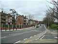
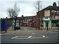
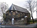
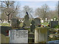
Photos of E12 9BG


Area Information
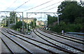
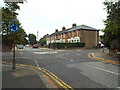
Living in E12 9BG means being part of a small, tightly knit residential cluster in east London. With a population of 1,607, this postcode area is compact but well-served by transport links and local amenities. The community here skews towards adults aged 30–64, reflecting a mature demographic. Flats dominate the housing stock, which is typical for this part of London. Daily life is shaped by proximity to rail and metro stations, with Manor Park and Woodgrange Park stations offering regular services to central London. The area’s modest size means residents are close to shops, schools, and green spaces, though its small footprint also means limited expansion. E12 9BG sits in a part of London where practicality trumps grandeur, with a focus on accessibility and affordability. For those seeking a manageable, connected environment without the chaos of larger urban hubs, this area offers a straightforward, no-frills alternative.
- Area Type
- Postcode
- Area Size
- Not available
- Population
- Not available
- Population Density
- Not available
The property market in E12 9BG is defined by a low home ownership rate of 24%, which suggests that the area is primarily a rental market rather than one dominated by owner-occupied homes. The accommodation type is predominantly flats, a common feature in smaller, high-density London postcode areas. This configuration means the housing stock is likely to be older, with limited scope for major redevelopment or expansion. For buyers, this small area and its immediate surroundings offer a limited selection of properties, which may be more appealing to those seeking short-term rentals or investment opportunities in a stable, established market. The flat-based stock also aligns with the area’s compact size, ensuring that properties are closely spaced and well-served by local amenities. However, the low home ownership rate may indicate challenges for long-term equity growth, making this area more suited to those prioritising location over property value appreciation.
House Prices in E12 9BG
No properties found in this postcode.
Energy Efficiency in E12 9BG
Residents of E12 9BG have access to a range of amenities within practical reach. Retail options include major supermarkets like Tesco Forestgate and Tesco Romford, ensuring everyday shopping needs are met. The area’s proximity to rail and metro stations, such as Wanstead Park and Upton Park, connects residents to broader leisure and cultural opportunities. Green spaces are limited, but nearby piers like North Greenwich Pier and Royal Wharf Pier provide waterfront access. While specific parks are not listed, the presence of multiple transport hubs suggests the area is integrated into London’s wider network of public spaces. The combination of retail, transport, and waterfront access contributes to a functional lifestyle, though the small postcode area means residents must venture slightly further for more expansive recreational options.
Amenities
Schools
| Rank | School | Type | Entry gender | Ages |
|---|
Explore more schools in this area
Go to Schools tabDemographics
The population of E12 9BG is 1,607, with a median age of 47. This suggests a community of middle-aged residents, predominantly in the 30–64 age range. Home ownership here is low, at just 24%, indicating that most residents are likely to be renters. Flats are the primary accommodation type, reflecting the area’s density and likely history as a purpose-built residential development. The predominant ethnic group is Asian_total, which shapes the cultural character of the neighbourhood. While specific data on deprivation is absent, the high proportion of renters and the age profile suggest a population that may prioritise affordability over property investment. This demographic structure implies a stable, settled community with established social networks, though the limited home ownership rate could indicate financial constraints or a preference for rental flexibility.
Household Size
Accommodation Type
Tenure
Ethnic Group
Religion
Household Composition
Age
Household Deprivation
NS-SEC
Explore more demographic insights in this area
Go to Demographics tabPlanning
Planning Constraints
- Flood RiskPremium
- Ramsar Wetland SitesPremium
- Area of Outstanding Natural BeautyPremium
- Protected Nature ReservePremium
- Protected WoodlandPremium