Area Overview for E12 6WG
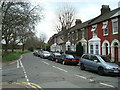
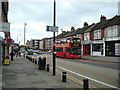
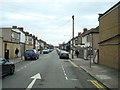
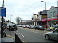
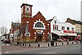
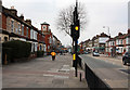
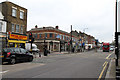
Photos of E12 6WG


Area Information
E12 6WG is a compact residential postcode in England, home to 2,486 people. It is a small, defined cluster of properties, likely centred around local amenities and transport links. The area’s character is shaped by its demographics: predominantly adults aged 30–64, with a median age of 47. This suggests a community of established professionals and families, many of whom may be renting rather than owning their homes. The postcode’s proximity to multiple transport hubs, including rail and metro stations, makes it a practical choice for commuters. While the area lacks natural reserves or protected landscapes, its low flood risk and absence of planning constraints offer reassurance for residents. E12 6WG is not a sprawling suburb but a focused residential pocket, where daily life revolves around nearby shops, schools, and public transport. Its appeal lies in its accessibility and the balance between urban convenience and a manageable population size.
- Area Type
- Postcode
- Area Size
- Not available
- Population
- 2486
- Population Density
- 15431 people/km²
The property market in E12 6WG is characterised by a high proportion of rental properties, with only 26% of homes owned by residents. This suggests a market skewed towards tenants rather than buyers, potentially due to the area’s size and the prevalence of flats. Flats dominate the accommodation type, which is typical in smaller urban postcode areas where space is limited. For buyers, this means competition for purchase opportunities may be limited, as the housing stock is primarily occupied by renters. The small size of the postcode also means the surrounding areas are critical for property searches. Prospective buyers should consider the area’s practicality for commuters, given its proximity to multiple transport hubs, but may find the market constrained by the low home ownership rate and limited housing diversity.
House Prices in E12 6WG
No properties found in this postcode.
Energy Efficiency in E12 6WG
Living in E12 6WG offers access to a range of amenities within walking or short transport distance. Retail options include major stores like Tesco Forestgate, Tesco Romford, and Tesco East Ham, providing everyday shopping convenience. The area’s proximity to rail and metro stations, such as Wanstead Park and Plaistow, ensures easy access to broader urban centres. Ferries at East India Pier and Woolwich Ferry North Pier connect residents to nearby riverside locations, adding to the area’s transport versatility. While the data does not specify parks or leisure facilities, the presence of multiple transport hubs suggests nearby green spaces or recreational areas are accessible. The mix of retail, transport, and proximity to London City Airport creates a practical, well-connected lifestyle, ideal for those prioritising convenience and connectivity over sprawling suburban amenities.
Amenities
Schools
| Rank | School | Type | Entry gender | Ages |
|---|
Explore more schools in this area
Go to Schools tabDemographics
The population of E12 6WG is dominated by adults aged 30–64, with a median age of 47. This suggests a mature, settled community, likely with a mix of long-term residents and those in their prime working years. Only 26% of households are owner-occupied, indicating that rental properties are the norm, which may reflect the area’s affordability or the prevalence of flats. The accommodation type is predominantly flats, a common feature in smaller urban postcode areas. The predominant ethnic group is Asian, which influences the cultural and social dynamics of the neighbourhood. While specific deprivation data is not provided, the combination of high rental rates and a mature population may suggest a community with established economic stability. However, the lack of data on income levels or deprivation means this remains speculative.
Household Size
Accommodation Type
Tenure
Ethnic Group
Religion
Household Composition
Age
Household Deprivation
NS-SEC
Explore more demographic insights in this area
Go to Demographics tabPlanning
Planning Constraints
- Flood RiskPremium
- Ramsar Wetland SitesPremium
- Area of Outstanding Natural BeautyPremium
- Protected Nature ReservePremium
- Protected WoodlandPremium