Area Overview for E12 6SD
Photos of E12 6SD
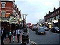


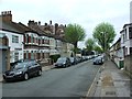


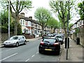
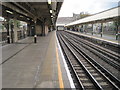
79 photos from this area
Area Information
Key information about the E12 6SD including its size, population, and administrative classification.
- Area Type
- Postcode
- Area Size
- 8291 m²
- Population
- 2309
- Population Density
- 20635 people/km²
House Prices in E12 6SD
49
Properties
£213,886
Average Sold Price
£27,000
Lowest Price
£490,000
Highest Price
Showing 49 properties
| Address | Type | Beds | Baths | Last Sale Price | Last Sale Date | |
|---|---|---|---|---|---|---|
| 75 Sibley Grove, Manor Park, London, E12 6SD | Terraced | 3 | 2 | £490,000 | May 2025 | |
| 41 Sibley Grove, Manor Park, London, E12 6SD | house | - | - | £465,000 | Nov 2021 | |
| 65 Sibley Grove, Manor Park, London, E12 6SD | Terraced | 4 | 3 | £420,000 | Dec 2017 | |
| 71A Sibley Grove, Manor Park, London, E12 6SD | Flat | - | - | £218,000 | Oct 2015 | |
| 79 Sibley Grove, Manor Park, London, E12 6SD | Flat | - | - | £200,000 | Jan 2015 | |
| 37 Sibley Grove, Manor Park, London, E12 6SD | house | - | - | £249,995 | Jul 2009 | |
| 59 Sibley Grove, Manor Park, London, E12 6SD | Terraced | 6 | 3 | £280,000 | Jul 2007 | |
| 15 Sibley Grove, Manor Park, London, E12 6SD | house | - | - | £249,950 | Nov 2006 | |
| 51 Sibley Grove, Manor Park, London, E12 6SD | house | - | - | £235,000 | Jan 2006 | |
| 29 Sibley Grove, Manor Park, London, E12 6SD | Terraced | 4 | 1 | £235,000 | Jul 2005 |
Page 1 of 5
Energy Efficiency in E12 6SD
Amenities
Schools
| Rank | School | Type | Entry gender | Ages |
|---|
Explore more schools in this area
Go to Schools tabDemographics
Household Size
Family (3-5 people)
most common
Accommodation Type
Houses
most common
Tenure
49
majority
Ethnic Group
asian_total
most common
Religion
N/A
most common
Household Composition
N/A
most common
Age
47
median
Adults (30-64 years)
most common
Household Deprivation
N/A
with no deprivation
NS-SEC
22
in Lower managerial occupations
Explore more demographic insights in this area
Go to Demographics tabPlanning
Planning Constraints
- Flood RiskPremium
- Ramsar Wetland SitesPremium
- Area of Outstanding Natural BeautyPremium
- Protected Nature ReservePremium
- Protected WoodlandPremium