Area Overview for E12 6PJ
Photos of E12 6PJ
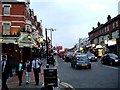


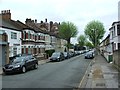


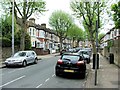
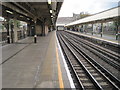
79 photos from this area
Area Information
Key information about the E12 6PJ including its size, population, and administrative classification.
- Area Type
- Postcode
- Area Size
- 5955 m²
- Population
- 2323
- Population Density
- 16932 people/km²
House Prices in E12 6PJ
43
Properties
£196,284
Average Sold Price
£54,950
Lowest Price
£400,000
Highest Price
Showing 43 properties
| Address | Type | Beds | Baths | Last Sale Price | Last Sale Date | |
|---|---|---|---|---|---|---|
| 51 Ruskin Avenue, Manor Park, London, E12 6PJ | Terraced | 3 | - | £400,000 | Dec 2019 | |
| 15 Ruskin Avenue, Manor Park, London, E12 6PJ | house | 3 | - | £187,100 | Mar 2018 | |
| 25 Ruskin Avenue, Manor Park, London, E12 6PJ | house | - | - | £272,500 | Jul 2015 | |
| 1 Ruskin Avenue, Manor Park, London, E12 6PJ | house | - | - | £247,000 | May 2013 | |
| 31 Ruskin Avenue, Manor Park, London, E12 6PJ | Terraced | - | - | £215,000 | Jun 2012 | |
| 33 Ruskin Avenue, Manor Park, London, E12 6PJ | house | - | - | £212,000 | Jul 2011 | |
| 65 Ruskin Avenue, Manor Park, London, E12 6PJ | Terraced | 5 | 2 | £242,000 | Sep 2010 | |
| 39 Ruskin Avenue, Manor Park, London, E12 6PJ | house | 3 | - | £249,995 | Aug 2010 | |
| 37 Ruskin Avenue, Manor Park, London, E12 6PJ | Terraced | 3 | 2 | £195,000 | Nov 2009 | |
| 17 Ruskin Avenue, Manor Park, London, E12 6PJ | house | - | - | £228,000 | Apr 2006 |
Page 1 of 5
Energy Efficiency in E12 6PJ
Amenities
Schools
| Rank | School | Type | Entry gender | Ages |
|---|
Explore more schools in this area
Go to Schools tabDemographics
Household Size
Family (3-5 people)
most common
Accommodation Type
Houses
most common
Tenure
46
majority
Ethnic Group
asian_total
most common
Religion
N/A
most common
Household Composition
N/A
most common
Age
47
median
Adults (30-64 years)
most common
Household Deprivation
N/A
with no deprivation
NS-SEC
17
in Lower managerial occupations
Explore more demographic insights in this area
Go to Demographics tabPlanning
Planning Constraints
- Flood RiskPremium
- Ramsar Wetland SitesPremium
- Area of Outstanding Natural BeautyPremium
- Protected Nature ReservePremium
- Protected WoodlandPremium