Area Overview for E12 6LB
Photos of E12 6LB
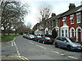
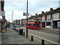
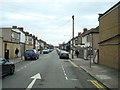
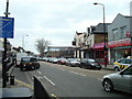
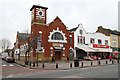
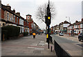


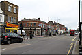
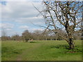
50 photos from this area
Area Information
Key information about the E12 6LB including its size, population, and administrative classification.
- Area Type
- Postcode
- Area Size
- 1.6 hectares
- Population
- 1659
- Population Density
- 11263 people/km²
House Prices in E12 6LB
66
Properties
£265,264
Average Sold Price
£56,000
Lowest Price
£480,000
Highest Price
Showing 66 properties
| Address | Type | Beds | Baths | Last Sale Price | Last Sale Date | |
|---|---|---|---|---|---|---|
| 46 Chesterford Road, Manor Park, London, E12 6LB | house | - | - | £325,000 | Feb 2025 | |
| 114 Chesterford Road, Manor Park, London, E12 6LB | Terraced | 3 | 1 | £475,000 | Oct 2024 | |
| 6 Chesterford Road, Manor Park, London, E12 6LB | Terraced | 4 | 2 | £480,000 | Nov 2022 | |
| 110 Chesterford Road, Manor Park, London, E12 6LB | house | - | - | £480,000 | Jun 2022 | |
| 102 Chesterford Road, Manor Park, London, E12 6LB | house | 3 | 2 | £425,000 | Jun 2022 | |
| 20 Chesterford Road, Manor Park, London, E12 6LB | house | - | - | £450,000 | Aug 2021 | |
| 2 Chesterford Road, Manor Park, London, E12 6LB | Terraced | 3 | 2 | £435,000 | Jun 2020 | |
| 88 Chesterford Road, Manor Park, London, E12 6LB | house | 3 | 1 | £345,000 | Jan 2020 | |
| 84 Chesterford Road, Manor Park, London, E12 6LB | Terraced | 3 | 1 | £377,500 | Sep 2018 | |
| 116 Chesterford Road, Manor Park, London, E12 6LB | Terraced | 3 | 2 | £395,000 | Oct 2017 |
Page 1 of 7
Energy Efficiency in E12 6LB
Amenities
Schools
| Rank | School | Type | Entry gender | Ages |
|---|
Explore more schools in this area
Go to Schools tabDemographics
Household Size
Family (3-5 people)
most common
Accommodation Type
Houses
most common
Tenure
45
majority
Ethnic Group
asian_total
most common
Religion
N/A
most common
Household Composition
N/A
most common
Age
47
median
Adults (30-64 years)
most common
Household Deprivation
N/A
with no deprivation
NS-SEC
18
in Lower managerial occupations
Explore more demographic insights in this area
Go to Demographics tabPlanning
Planning Constraints
- Flood RiskPremium
- Ramsar Wetland SitesPremium
- Area of Outstanding Natural BeautyPremium
- Protected Nature ReservePremium
- Protected WoodlandPremium