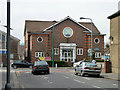
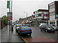
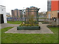
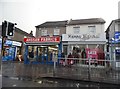
Area Overview for E12 6HU
Photos of E12 6HU


Area Information
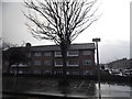
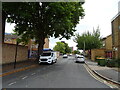
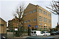
E12 6HU is a small residential cluster in east London with a population of 2001, offering a compact yet functional living environment. The area’s character is defined by its proximity to transport networks and retail hubs, making it accessible for commuters and shoppers. Residents benefit from a mix of local amenities, including major supermarkets like Tesco Romford and Sainsburys Ilford, which cater to daily needs. The community is predominantly composed of adults aged 30–64, reflecting a mature demographic that may appeal to professionals or families seeking stability. While the area lacks natural landscapes or protected sites, its connectivity to rail, metro, and ferry services ensures easy access to London’s broader infrastructure. With excellent broadband quality and a moderate crime risk, E12 6HU balances practicality with the essentials of urban living. For those prioritising convenience over scenic surroundings, this postcode offers a straightforward, no-frills lifestyle within a well-served urban framework.
- Area Type
- Postcode
- Area Size
- Not available
- Population
- 2001
- Population Density
- 8957 people/km²
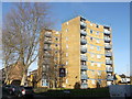
E12 6HU’s property market is characterised by a low home ownership rate of 34%, indicating that most residents rent rather than own their homes. The area is dominated by houses, which is unusual for inner London, suggesting a niche market for those seeking single-family properties. This mix of rental availability and house-centric stock may appeal to buyers looking for space or families requiring larger homes. However, the small population and limited housing stock mean the market is unlikely to be highly competitive. Buyers should consider nearby areas for more options, though E12 6HU’s proximity to transport links and retail hubs could offset its smaller scale. The predominance of houses also implies higher maintenance costs compared to flats, which is a practical consideration for potential purchasers.
House Prices in E12 6HU
No properties found in this postcode.
Energy Efficiency in E12 6HU
Living in E12 6HU offers access to a range of amenities within practical reach. Retail options include major supermarkets like Tesco Romford and Sainsburys Ilford, ensuring everyday shopping needs are met. The area’s transport links, such as Ilford Station and East Ham Station, provide easy access to London’s rail and metro systems, while ferry services at Woolwich Arsenal Pier connect residents to the Thames. The presence of Whipps Cross Bus Interchange adds convenience for local travel. Though the area lacks parks or leisure facilities, its proximity to multiple transport hubs and retail centres makes it ideal for those prioritising accessibility over green spaces. The mix of shops, transport, and nearby airports creates a functional lifestyle, particularly for commuters or those requiring frequent travel.
Amenities
Schools
| Rank | School | Type | Entry gender | Ages |
|---|
Explore more schools in this area
Go to Schools tabDemographics
The population of E12 6HU is 2001, with a median age of 47, indicating a mature community where adults aged 30–64 form the largest age group. Home ownership is relatively low at 34%, suggesting a significant proportion of residents rent their homes. The area is predominantly composed of houses, which is uncommon in many urban zones, implying a focus on single-family living. The predominant ethnic group is Asian_total, reflecting a culturally diverse population. This demographic profile suggests a community that is likely family-oriented, with a mix of long-term residents and those seeking affordable housing. The absence of specific deprivation data means the quality of life cannot be fully assessed, but the age distribution and housing type indicate a stable, established neighbourhood.
Household Size
Accommodation Type
Tenure
Ethnic Group
Religion
Household Composition
Age
Household Deprivation
NS-SEC
Explore more demographic insights in this area
Go to Demographics tabPlanning
Planning Constraints
- Flood RiskPremium
- Ramsar Wetland SitesPremium
- Area of Outstanding Natural BeautyPremium
- Protected Nature ReservePremium
- Protected WoodlandPremium