Area Overview for E12 5RA
Photos of E12 5RA
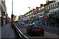
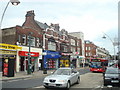
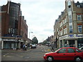

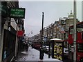
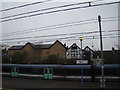
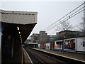
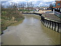
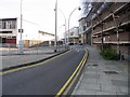
100 photos from this area
Area Information
Key information about the E12 5RA including its size, population, and administrative classification.
- Area Type
- Postcode
- Area Size
- 1628 m²
- Population
- Not available
- Population Density
- Not available
House Prices in E12 5RA
20
Properties
£142,992
Average Sold Price
£45,000
Lowest Price
£355,000
Highest Price
Showing 20 properties
| Address | Type | Beds | Baths | Last Sale Price | Last Sale Date | |
|---|---|---|---|---|---|---|
| 11 Walton Road, Manor Park, London, E12 5RA | Maisonette | - | - | £355,000 | Feb 2023 | |
| 27 Walton Road, Manor Park, London, E12 5RA | Maisonette | - | - | £150,000 | Feb 2012 | |
| 23 Walton Road, Manor Park, London, E12 5RA | Flat | - | - | £121,000 | Dec 2003 | |
| 29 Walton Road, Manor Park, London, E12 5RA | Flat | 2 | - | £130,000 | Sep 2003 | |
| 21 Walton Road, Manor Park, London, E12 5RA | Flat | - | - | £56,950 | Dec 1999 | |
| 15 Walton Road, Manor Park, London, E12 5RA | Flat | - | - | £45,000 | Feb 1999 | |
| Second Floor And Third Floor Flat, 29 Walton Road, Manor Park, London, E12 5RA | undefined | - | - | - | - | |
| 25 Walton Road, Manor Park, London, E12 5RA | undefined | - | - | - | - | |
| 23 Walton Road, Manor Park, London, E12 5RA | undefined | - | - | - | - | |
| 27 Walton Road, Manor Park, London, E12 5RA | undefined | - | - | - | - |
Page 1 of 2
Energy Efficiency in E12 5RA
Amenities
Schools
| Rank | School | Type | Entry gender | Ages |
|---|
Explore more schools in this area
Go to Schools tabDemographics
Household Size
Family (3-5 people)
most common
Accommodation Type
Flats
most common
Tenure
26
majority
Ethnic Group
asian_total
most common
Religion
N/A
most common
Household Composition
N/A
most common
Age
22
median
Adults (30-64 years)
most common
Household Deprivation
N/A
with no deprivation
NS-SEC
18
in Lower managerial occupations
Explore more demographic insights in this area
Go to Demographics tabPlanning
Planning Constraints
- Flood RiskPremium
- Ramsar Wetland SitesPremium
- Area of Outstanding Natural BeautyPremium
- Protected Nature ReservePremium
- Protected WoodlandPremium