Area Overview for E12 5AJ
Photos of E12 5AJ
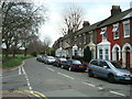
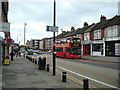
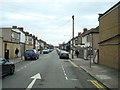
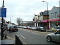
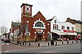
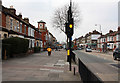


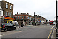
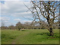
50 photos from this area
Area Information
Key information about the E12 5AJ including its size, population, and administrative classification.
- Area Type
- Postcode
- Area Size
- 4658 m²
- Population
- Not available
- Population Density
- Not available
House Prices in E12 5AJ
37
Properties
£225,500
Average Sold Price
£65,000
Lowest Price
£552,000
Highest Price
Showing 37 properties
| Address | Type | Beds | Baths | Last Sale Price | Last Sale Date | |
|---|---|---|---|---|---|---|
| 684A Romford Road, Manor Park, London, E12 5AJ | Flat | 2 | 1 | £215,000 | Jun 2018 | |
| 704B Romford Road, Manor Park, London, E12 5AJ | Flat | - | - | £552,000 | Mar 2015 | |
| 706A Romford Road, Manor Park, London, E12 5AJ | Flat | - | - | £70,000 | May 1998 | |
| FLAT ABOVE, 686 ROMFORD ROAD, Manor Park, London, E12 5AJ | Flat | - | - | £65,000 | Dec 1997 | |
| 678A Romford Road, Manor Park, London, E12 5AJ | Flat | - | - | - | - | |
| 696A Romford Road, Manor Park, London, E12 5AJ | Flat | 1 | 1 | - | - | |
| First Floor Flat, 680 Romford Road, Manor Park, London, E12 5AJ | undefined | - | - | - | - | |
| 670 Romford Road, Forest Gate, London, E12 5AJ | undefined | - | - | - | - | |
| First Floor Flat, 704B Romford Road, Manor Park, London, E12 5AJ | undefined | - | - | - | - | |
| Room 3, 672A Romford Road, Manor Park, London, E12 5AJ | Retirement | - | - | - | - |
Page 1 of 4
Energy Efficiency in E12 5AJ
Amenities
Schools
| Rank | School | Type | Entry gender | Ages |
|---|
Explore more schools in this area
Go to Schools tabDemographics
Household Size
Family (3-5 people)
most common
Accommodation Type
Flats
most common
Tenure
27
majority
Ethnic Group
asian_total
most common
Religion
N/A
most common
Household Composition
N/A
most common
Age
47
median
Adults (30-64 years)
most common
Household Deprivation
N/A
with no deprivation
NS-SEC
17
in Lower managerial occupations
Explore more demographic insights in this area
Go to Demographics tabPlanning
Planning Constraints
- Flood RiskPremium
- Ramsar Wetland SitesPremium
- Area of Outstanding Natural BeautyPremium
- Protected Nature ReservePremium
- Protected WoodlandPremium