Area Overview for E11 4RQ
Photos of E11 4RQ
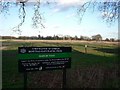
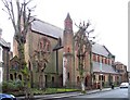
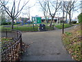
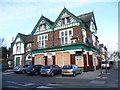
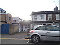
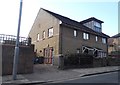
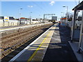
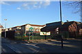
88 photos from this area
Area Information
Key information about the E11 4RQ including its size, population, and administrative classification.
- Area Type
- Postcode
- Area Size
- 6249 m²
- Population
- 1883
- Population Density
- 18079 people/km²
House Prices in E11 4RQ
56
Properties
£364,790
Average Sold Price
£49,500
Lowest Price
£710,000
Highest Price
Showing 56 properties
| Address | Type | Beds | Baths | Last Sale Price | Last Sale Date | |
|---|---|---|---|---|---|---|
| 84 Granleigh Road, Leytonstone, E11 4RQ | Terraced | 3 | 1 | £621,500 | Jan 2025 | |
| 94 Granleigh Road, Leytonstone, E11 4RQ | house | - | - | £375,000 | Jan 2025 | |
| 96 Granleigh Road, Leytonstone, E11 4RQ | house | - | - | £647,475 | Feb 2023 | |
| 72 Granleigh Road, Leytonstone, E11 4RQ | house | - | - | £710,000 | Jun 2021 | |
| First Floor Flat 2, 80 Granleigh Road, Leytonstone, E11 4RQ | Flat | 3 | 1 | £435,000 | Mar 2021 | |
| 48 Granleigh Road, Leytonstone, E11 4RQ | house | - | - | £526,800 | Feb 2021 | |
| 74 Granleigh Road, Leytonstone, E11 4RQ | Terraced | 3 | 1 | £555,100 | Dec 2020 | |
| 60A Granleigh Road, Leytonstone, E11 4RQ | Flat | 1 | 1 | £341,000 | Feb 2020 | |
| 54A Granleigh Road, Leytonstone, E11 4RQ | Maisonette | 1 | - | £295,000 | Jul 2018 | |
| 104 Granleigh Road, Leytonstone, E11 4RQ | house | - | - | £489,000 | Jul 2017 |
Page 1 of 6
Energy Efficiency in E11 4RQ
Amenities
Schools
| Rank | School | Type | Entry gender | Ages |
|---|
Explore more schools in this area
Go to Schools tabDemographics
Household Size
Family (3-5 people)
most common
Accommodation Type
Houses
most common
Tenure
46
majority
Ethnic Group
White
most common
Religion
N/A
most common
Household Composition
N/A
most common
Age
47
median
Adults (30-64 years)
most common
Household Deprivation
N/A
with no deprivation
NS-SEC
37
in Lower managerial occupations
Explore more demographic insights in this area
Go to Demographics tabPlanning
Planning Constraints
- Flood RiskPremium
- Ramsar Wetland SitesPremium
- Area of Outstanding Natural BeautyPremium
- Protected Nature ReservePremium
- Protected WoodlandPremium