Area Overview for E11 4DS
Photos of E11 4DS


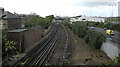
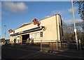
100 photos from this area
Area Information
Key information about the E11 4DS including its size, population, and administrative classification.
- Area Type
- Postcode
- Area Size
- 5782 m²
- Population
- 1967
- Population Density
- 15225 people/km²
House Prices in E11 4DS
43
Properties
£304,618
Average Sold Price
£50,000
Lowest Price
£765,000
Highest Price
Showing 43 properties
| Address | Type | Beds | Baths | Last Sale Price | Last Sale Date | |
|---|---|---|---|---|---|---|
| 113 Ashville Road, Leytonstone, E11 4DS | Detached | 3 | 1 | £650,000 | Nov 2024 | |
| 87 Ashville Road, Leytonstone, E11 4DS | Terraced | 2 | 1 | £765,000 | Jun 2023 | |
| 75 Ashville Road, Leytonstone, E11 4DS | Terraced | 3 | 1 | £590,000 | Oct 2021 | |
| 97 Ashville Road, Leytonstone, E11 4DS | Flat | 3 | 1 | £449,000 | Oct 2021 | |
| 81 Ashville Road, Leytonstone, E11 4DS | Terraced | 2 | - | £575,000 | Jun 2021 | |
| 101 Ashville Road, Leytonstone, E11 4DS | Flat | 2 | 1 | £461,000 | May 2021 | |
| 79 Ashville Road, Leytonstone, E11 4DS | Terraced | 3 | 1 | £510,000 | Nov 2018 | |
| 95 Ashville Road, Leytonstone, E11 4DS | Flat | - | - | £330,000 | Aug 2018 | |
| 65 Ashville Road, Leytonstone, E11 4DS | Terraced | 3 | 1 | £515,000 | Nov 2015 | |
| 127 Ashville Road, Leytonstone, E11 4DS | house | - | - | £240,000 | Jun 2014 |
Page 1 of 5
Energy Efficiency in E11 4DS
Amenities
Schools
| Rank | School | Type | Entry gender | Ages |
|---|
Explore more schools in this area
Go to Schools tabDemographics
Household Size
Family (3-5 people)
most common
Accommodation Type
Houses
most common
Tenure
52
majority
Ethnic Group
White
most common
Religion
N/A
most common
Household Composition
N/A
most common
Age
47
median
Adults (30-64 years)
most common
Household Deprivation
N/A
with no deprivation
NS-SEC
37
in Lower managerial occupations
Explore more demographic insights in this area
Go to Demographics tabPlanning
Planning Constraints
- Flood RiskPremium
- Ramsar Wetland SitesPremium
- Area of Outstanding Natural BeautyPremium
- Protected Nature ReservePremium
- Protected WoodlandPremium