Area Overview for E11 4DJ
Photos of E11 4DJ
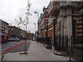
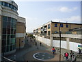
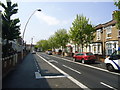
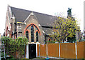


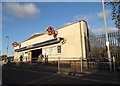
100 photos from this area
Area Information
Key information about the E11 4DJ including its size, population, and administrative classification.
- Area Type
- Postcode
- Area Size
- 8677 m²
- Population
- 1967
- Population Density
- 15225 people/km²
House Prices in E11 4DJ
63
Properties
£387,808
Average Sold Price
£55,500
Lowest Price
£820,000
Highest Price
Showing 63 properties
| Address | Type | Beds | Baths | Last Sale Price | Last Sale Date | |
|---|---|---|---|---|---|---|
| 55 Oakdale Road, Leytonstone, E11 4DJ | Flat | 2 | 1 | £450,000 | Sep 2025 | |
| 89 Oakdale Road, Leytonstone, E11 4DJ | Terraced | 2 | 1 | £600,000 | Feb 2025 | |
| 13 Oakdale Road, Leytonstone, E11 4DJ | house | 3 | 1 | £585,000 | Oct 2024 | |
| 79 Oakdale Road, Leytonstone, E11 4DJ | house | - | - | £620,000 | Jun 2024 | |
| 49 Oakdale Road, Leytonstone, E11 4DJ | Terraced | 2 | 1 | £706,000 | May 2024 | |
| 45 Oakdale Road, Leytonstone, E11 4DJ | Terraced | 3 | 1 | £607,750 | Dec 2023 | |
| 113 Oakdale Road, Leytonstone, E11 4DJ | Terraced | 2 | 1 | £615,000 | Oct 2023 | |
| 23 Oakdale Road, Leytonstone, E11 4DJ | Terraced | 3 | 1 | £636,500 | Aug 2023 | |
| 11 Oakdale Road, Leytonstone, E11 4DJ | Terraced | 3 | 1 | £820,000 | Feb 2023 | |
| 51 Oakdale Road, Leytonstone, E11 4DJ | house | - | - | £556,000 | Dec 2022 |
Page 1 of 7
Energy Efficiency in E11 4DJ
Amenities
Schools
| Rank | School | Type | Entry gender | Ages |
|---|
Explore more schools in this area
Go to Schools tabDemographics
Household Size
Family (3-5 people)
most common
Accommodation Type
Houses
most common
Tenure
52
majority
Ethnic Group
White
most common
Religion
N/A
most common
Household Composition
N/A
most common
Age
47
median
Adults (30-64 years)
most common
Household Deprivation
N/A
with no deprivation
NS-SEC
37
in Lower managerial occupations
Explore more demographic insights in this area
Go to Demographics tabPlanning
Planning Constraints
- Flood RiskPremium
- Ramsar Wetland SitesPremium
- Area of Outstanding Natural BeautyPremium
- Protected Nature ReservePremium
- Protected WoodlandPremium