Area Overview for E11 4BH
Photos of E11 4BH
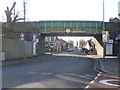
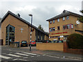
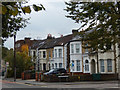

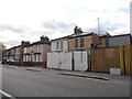
92 photos from this area
Area Information
Key information about the E11 4BH including its size, population, and administrative classification.
- Area Type
- Postcode
- Area Size
- 8312 m²
- Population
- 1646
- Population Density
- 15115 people/km²
House Prices in E11 4BH
49
Properties
£504,158
Average Sold Price
£63,500
Lowest Price
£965,000
Highest Price
Showing 49 properties
| Address | Type | Beds | Baths | Last Sale Price | Last Sale Date | |
|---|---|---|---|---|---|---|
| 144 Twickenham Road, Leytonstone, E11 4BH | Terraced | 3 | 2 | £965,000 | Jan 2025 | |
| 146 Twickenham Road, Leytonstone, E11 4BH | Terraced | 3 | 1 | £786,500 | Dec 2024 | |
| 142 Twickenham Road, Leytonstone, E11 4BH | Terraced | 3 | 1 | £640,000 | Jan 2024 | |
| 196 Twickenham Road, Leytonstone, E11 4BH | Terraced | 3 | 2 | £934,000 | Aug 2023 | |
| 188 Twickenham Road, Leytonstone, E11 4BH | house | 4 | 2 | £927,525 | Jun 2022 | |
| 166 Twickenham Road, Leytonstone, E11 4BH | house | - | - | £600,000 | Sep 2021 | |
| 202 Twickenham Road, Leytonstone, E11 4BH | house | 2 | 1 | £770,000 | Jun 2021 | |
| 214 Twickenham Road, Leytonstone, E11 4BH | house | - | - | £850,000 | Jun 2021 | |
| 176 Twickenham Road, Leytonstone, E11 4BH | house | - | - | £780,000 | May 2021 | |
| 200 Twickenham Road, Leytonstone, E11 4BH | Terraced | 5 | 2 | £690,000 | Mar 2021 |
Page 1 of 5
Energy Efficiency in E11 4BH
Amenities
Schools
| Rank | School | Type | Entry gender | Ages |
|---|
Explore more schools in this area
Go to Schools tabDemographics
Household Size
Family (3-5 people)
most common
Accommodation Type
Houses
most common
Tenure
50
majority
Ethnic Group
White
most common
Religion
N/A
most common
Household Composition
N/A
most common
Age
47
median
Adults (30-64 years)
most common
Household Deprivation
N/A
with no deprivation
NS-SEC
40
in Lower managerial occupations
Explore more demographic insights in this area
Go to Demographics tabPlanning
Planning Constraints
- Flood RiskPremium
- Ramsar Wetland SitesPremium
- Area of Outstanding Natural BeautyPremium
- Protected Nature ReservePremium
- Protected WoodlandPremium