Area Overview for E11 3AY
Photos of E11 3AY
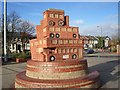
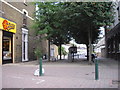
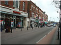
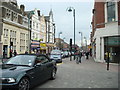
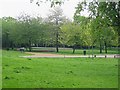
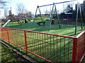
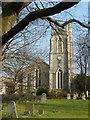
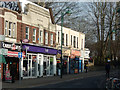
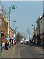
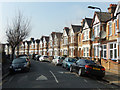
100 photos from this area
Area Information
Key information about the E11 3AY including its size, population, and administrative classification.
- Area Type
- Postcode
- Area Size
- 1.0 hectares
- Population
- 2142
- Population Density
- 8306 people/km²
House Prices in E11 3AY
23
Properties
£486,350
Average Sold Price
£180,000
Lowest Price
£1,000,000
Highest Price
Showing 23 properties
| Address | Type | Beds | Baths | Last Sale Price | Last Sale Date | |
|---|---|---|---|---|---|---|
| 5A Bushwood, Leytonstone, E11 3AY | Flat | - | - | £510,000 | Feb 2021 | |
| 12 Bushwood, Leytonstone, E11 3AY | house | - | - | £710,000 | Aug 2012 | |
| 5 Bushwood, Leytonstone, E11 3AY | Maisonette | - | - | £238,000 | Oct 2010 | |
| 15 Bushwood, Leytonstone, E11 3AY | Detached | 6 | 2 | £1,000,000 | Apr 2008 | |
| 16 Bushwood, Leytonstone, E11 3AY | Detached | - | - | £625,500 | Jan 2006 | |
| Sylvan Lodge, 8 Bushwood, Leytonstone, E11 3AY | Terraced | - | - | £625,000 | Jan 2004 | |
| 6 Bushwood, Leytonstone, E11 3AY | Semi-detached | - | - | £250,000 | Mar 2003 | |
| 13 Bushwood, Leytonstone, E11 3AY | hospital_care_home | - | - | £225,000 | Apr 2002 | |
| 7 Bushwood, Leytonstone, E11 3AY | house | - | - | £180,000 | Oct 2000 | |
| 14 Bushwood, Leytonstone, E11 3AY | Retirement | - | - | £500,000 | Aug 2000 |
Page 1 of 3
Energy Efficiency in E11 3AY
Amenities
Schools
| Rank | School | Type | Entry gender | Ages |
|---|
Explore more schools in this area
Go to Schools tabDemographics
Household Size
Two person
most common
Accommodation Type
Houses
most common
Tenure
45
majority
Ethnic Group
White
most common
Religion
N/A
most common
Household Composition
N/A
most common
Age
47
median
Adults (30-64 years)
most common
Household Deprivation
N/A
with no deprivation
NS-SEC
42
in Lower managerial occupations
Explore more demographic insights in this area
Go to Demographics tabPlanning
Planning Constraints
- Flood RiskPremium
- Ramsar Wetland SitesPremium
- Area of Outstanding Natural BeautyPremium
- Protected Nature ReservePremium
- Protected WoodlandPremium