Area Overview for E11 2RR
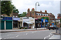
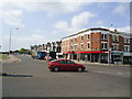
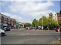
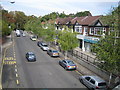
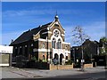
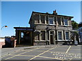
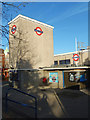
Photos of E11 2RR


Area Information
E11 2RR is a small residential postcode area in England, home to around 1945 residents. It is a tightly knit community characterised by a mature population, with a median age of 47 and a majority of residents aged between 30 and 64. The area’s compact size means it is a quiet, localised cluster of homes, predominantly flats, which reflects its urban setting. Daily life here is shaped by proximity to essential services and transport links. The presence of nearby schools, shops, and multiple public transport options ensures residents have access to convenience without the need for long commutes. While the area lacks large-scale amenities, its practical reach includes retail outlets like Co-op Wanstead and M&S Wanstead, as well as train stations such as Wanstead and Snaresbrook. For those seeking a balance between urban accessibility and a sense of community, E11 2RR offers a straightforward, no-frills living experience.
- Area Type
- Postcode
- Area Size
- Not available
- Population
- 1945
- Population Density
- 5556 people/km²
The property market in E11 2RR is defined by its high proportion of flats, with 53% of homes owned by residents. This suggests a mix of owner-occupied and rental properties, though the data does not specify the exact split between the two. The prevalence of flats indicates a focus on smaller, urban housing, which may appeal to those prioritising convenience over space. Given the area’s compact size, property options are limited to the immediate vicinity, making it a niche market for buyers seeking affordability or proximity to transport. The small population and lack of large-scale development mean the housing stock is unlikely to undergo significant change. For buyers, this presents a straightforward but limited selection, with prices potentially influenced by the area’s proximity to key services and transport hubs.
House Prices in E11 2RR
No properties found in this postcode.
Energy Efficiency in E11 2RR
The lifestyle in E11 2RR is shaped by its proximity to a range of amenities. Retail options include five shops, such as Co-op Wanstead and M&S Wanstead, providing everyday essentials. The area’s transport links, including Wanstead Station and Snaresbrook Station, offer easy access to surrounding districts. For leisure, the presence of ferry piers and London City Airport may cater to specific travel needs, though their frequency or relevance to daily life is not detailed. The absence of large parks or recreational spaces suggests that residents may need to travel further for outdoor activities. Despite this, the area’s compact design ensures that basic amenities are within walking or short transit distance, supporting a practical, low-maintenance lifestyle.
Amenities
Schools
The nearest school to E11 2RR is Wanstead Church School, a primary school with a good Ofsted rating. This institution serves the local community, providing education for younger children within the area. The absence of secondary schools in the immediate vicinity means families may need to consider nearby districts for older children’s schooling. However, the quality of the primary school is a positive factor for those prioritising early education. The school’s rating suggests a standard of teaching and facilities that meets regulatory benchmarks, though no additional data on pupil performance or facilities is available. For parents, the presence of a well-regarded primary school is a key consideration in evaluating the area’s suitability for family living.
| Rank | School | Type | Entry gender | Ages |
|---|
Explore more schools in this area
Go to Schools tabDemographics
The population of E11 2RR is predominantly adults aged 30 to 64, with a median age of 47. Home ownership accounts for 53% of households, though the accommodation type is largely flats, suggesting a mix of owner-occupied and rental properties. The predominant ethnic group is White, though the data does not provide further breakdowns on diversity. The age profile indicates a stable, middle-aged population, which may influence local services and amenities. With 1945 residents, the area is small enough to foster a close-knit community but large enough to support basic infrastructure. The lack of specific data on deprivation or socioeconomic distribution means the quality of life is inferred from the availability of services and transport, which appear adequate for daily needs.
Household Size
Accommodation Type
Tenure
Ethnic Group
Religion
Household Composition
Age
Household Deprivation
NS-SEC
Explore more demographic insights in this area
Go to Demographics tabPlanning
Planning Constraints
- Flood RiskPremium
- Ramsar Wetland SitesPremium
- Area of Outstanding Natural BeautyPremium
- Protected Nature ReservePremium
- Protected WoodlandPremium