Area Overview for E11 2NA
Photos of E11 2NA
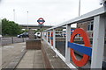
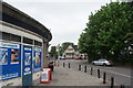
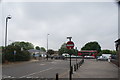
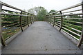
82 photos from this area
Area Information
Key information about the E11 2NA including its size, population, and administrative classification.
- Area Type
- Postcode
- Area Size
- 9.5 hectares
- Population
- 1235
- Population Density
- 1569 people/km²
House Prices in E11 2NA
36
Properties
£614,140
Average Sold Price
£125,000
Lowest Price
£1,510,000
Highest Price
Showing 36 properties
| Address | Type | Beds | Baths | Last Sale Price | Last Sale Date | |
|---|---|---|---|---|---|---|
| 46 Warren Road, Wanstead, London, E11 2NA | Detached | 4 | 2 | £1,175,000 | Oct 2024 | |
| 2 Warren Road, Wanstead, London, E11 2NA | house | - | - | £1,510,000 | May 2023 | |
| 44 Warren Road, Wanstead, London, E11 2NA | Retail | 4 | - | £1,050,000 | Aug 2022 | |
| 18 Warren Road, Wanstead, London, E11 2NA | Retail | 3 | 1 | £1,116,500 | Apr 2022 | |
| 42 Warren Road, Wanstead, London, E11 2NA | house | - | - | £1,330,000 | Dec 2020 | |
| 26 Warren Road, Wanstead, London, E11 2NA | house | - | - | £1,000,000 | Aug 2020 | |
| 56 Warren Road, Wanstead, London, E11 2NA | Terraced | 3 | 2 | £872,000 | Nov 2019 | |
| 34 Warren Road, Wanstead, London, E11 2NA | Semi-detached | 3 | 1 | £870,000 | Jul 2019 | |
| 38 Warren Road, Wanstead, London, E11 2NA | house | - | - | £750,000 | May 2015 | |
| 12 Warren Road, Wanstead, London, E11 2NA | house | - | - | £880,000 | Jul 2014 |
Page 1 of 4
Energy Efficiency in E11 2NA
Amenities
Schools
| Rank | School | Type | Entry gender | Ages |
|---|
Explore more schools in this area
Go to Schools tabDemographics
Household Size
Family (3-5 people)
most common
Accommodation Type
Houses
most common
Tenure
91
majority
Ethnic Group
White
most common
Religion
N/A
most common
Household Composition
N/A
most common
Age
47
median
Adults (30-64 years)
most common
Household Deprivation
N/A
with no deprivation
NS-SEC
54
in Lower managerial occupations
Explore more demographic insights in this area
Go to Demographics tabPlanning
Planning Constraints
- Flood RiskPremium
- Ramsar Wetland SitesPremium
- Area of Outstanding Natural BeautyPremium
- Protected Nature ReservePremium
- Protected WoodlandPremium