Area Overview for E11 2LW
Photos of E11 2LW
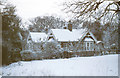
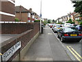

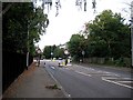

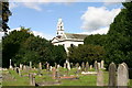
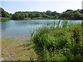
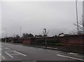

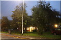
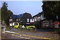

48 photos from this area
Area Information
Key information about the E11 2LW including its size, population, and administrative classification.
- Area Type
- Postcode
- Area Size
- 27.1 hectares
- Population
- 1235
- Population Density
- 1569 people/km²
House Prices in E11 2LW
30
Properties
£677,246
Average Sold Price
£215,000
Lowest Price
£1,065,000
Highest Price
Showing 30 properties
| Address | Type | Beds | Baths | Last Sale Price | Last Sale Date | |
|---|---|---|---|---|---|---|
| 39 Overton Drive, Wanstead, London, E11 2LW | Detached | 4 | 3 | £772,000 | Aug 2019 | |
| 57 Overton Drive, Wanstead, London, E11 2LW | house | - | - | £1,065,000 | Jul 2019 | |
| 63 Overton Drive, Wanstead, London, E11 2LW | Terraced | 4 | 2 | £930,000 | Oct 2018 | |
| 43 Overton Drive, Wanstead, London, E11 2LW | Terraced | 4 | 2 | £947,200 | Jul 2018 | |
| 65 Overton Drive, Wanstead, London, E11 2LW | house | - | - | £900,000 | Sep 2015 | |
| 71 Overton Drive, Wanstead, London, E11 2LW | house | - | - | £900,000 | Jan 2015 | |
| 41 Overton Drive, Wanstead, London, E11 2LW | house | - | - | £810,000 | Aug 2014 | |
| 47 Overton Drive, Wanstead, London, E11 2LW | house | 4 | - | £645,000 | Mar 2013 | |
| 53 Overton Drive, Wanstead, London, E11 2LW | house | - | - | £645,000 | Jul 2011 | |
| 69 Overton Drive, Wanstead, London, E11 2LW | Terraced | - | - | £450,000 | Aug 2006 |
Page 1 of 3
Energy Efficiency in E11 2LW
Amenities
Schools
| Rank | School | Type | Entry gender | Ages |
|---|
Explore more schools in this area
Go to Schools tabDemographics
Household Size
Family (3-5 people)
most common
Accommodation Type
Houses
most common
Tenure
91
majority
Ethnic Group
White
most common
Religion
N/A
most common
Household Composition
N/A
most common
Age
47
median
Adults (30-64 years)
most common
Household Deprivation
N/A
with no deprivation
NS-SEC
54
in Lower managerial occupations
Explore more demographic insights in this area
Go to Demographics tabPlanning
Planning Constraints
- Flood RiskPremium
- Ramsar Wetland SitesPremium
- Area of Outstanding Natural BeautyPremium
- Protected Nature ReservePremium
- Protected WoodlandPremium