Area Overview for E11 2ES
Photos of E11 2ES
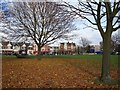
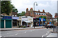

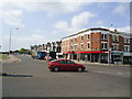
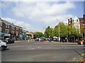


100 photos from this area
Area Information
Key information about the E11 2ES including its size, population, and administrative classification.
- Area Type
- Postcode
- Area Size
- 1.2 hectares
- Population
- 1824
- Population Density
- 7745 people/km²
House Prices in E11 2ES
26
Properties
£848,097
Average Sold Price
£143,000
Lowest Price
£2,100,000
Highest Price
Showing 26 properties
| Address | Type | Beds | Baths | Last Sale Price | Last Sale Date | |
|---|---|---|---|---|---|---|
| 65 Grosvenor Road, Wanstead, London, E11 2ES | Semi-detached | 4 | 1 | £1,207,400 | Oct 2024 | |
| 58 Grosvenor Road, Wanstead, London, E11 2ES | Semi-detached | 5 | 2 | £2,100,000 | Aug 2024 | |
| 73 Grosvenor Road, Wanstead, London, E11 2ES | Retail | 4 | 1 | £1,500,000 | Jun 2022 | |
| 49 Grosvenor Road, Wanstead, London, E11 2ES | house | - | - | £1,410,000 | Jun 2021 | |
| 72 Grosvenor Road, Wanstead, London, E11 2ES | house | - | - | £825,000 | Jul 2016 | |
| 47 Grosvenor Road, Wanstead, London, E11 2ES | Semi-detached | 6 | 2 | £1,276,000 | Jun 2015 | |
| 64 Grosvenor Road, Wanstead, London, E11 2ES | house | - | - | £1,000,000 | Feb 2015 | |
| 56 Grosvenor Road, Wanstead, London, E11 2ES | house | - | - | £700,000 | Sep 2013 | |
| 57 Grosvenor Road, Wanstead, London, E11 2ES | house | - | - | £780,000 | Aug 2013 | |
| 51 Grosvenor Road, Wanstead, London, E11 2ES | house | 4 | - | £647,500 | Aug 2013 |
Page 1 of 3
Energy Efficiency in E11 2ES
Amenities
Schools
| Rank | School | Type | Entry gender | Ages |
|---|
Explore more schools in this area
Go to Schools tabDemographics
Household Size
One person
most common
Accommodation Type
Flats
most common
Tenure
61
majority
Ethnic Group
White
most common
Religion
N/A
most common
Household Composition
N/A
most common
Age
47
median
Adults (30-64 years)
most common
Household Deprivation
N/A
with no deprivation
NS-SEC
56
in Lower managerial occupations
Explore more demographic insights in this area
Go to Demographics tabPlanning
Planning Constraints
- Flood RiskPremium
- Ramsar Wetland SitesPremium
- Area of Outstanding Natural BeautyPremium
- Protected Nature ReservePremium
- Protected WoodlandPremium