Area Overview for E11 2EF
Photos of E11 2EF
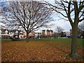
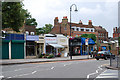
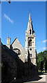
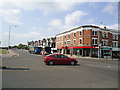
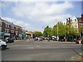
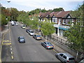
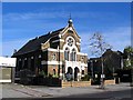
100 photos from this area
Area Information
Key information about the E11 2EF including its size, population, and administrative classification.
- Area Type
- Postcode
- Area Size
- 2.2 hectares
- Population
- 1824
- Population Density
- 7745 people/km²
House Prices in E11 2EF
32
Properties
£1,032,273
Average Sold Price
£220,000
Lowest Price
£1,900,000
Highest Price
Showing 32 properties
| Address | Type | Beds | Baths | Last Sale Price | Last Sale Date | |
|---|---|---|---|---|---|---|
| 12 The Avenue, Wanstead, London, E11 2EF | house | - | - | £1,900,000 | Jun 2021 | |
| 20 The Avenue, Wanstead, London, E11 2EF | Detached | - | - | £1,300,000 | Aug 2019 | |
| 32 The Avenue, Wanstead, London, E11 2EF | Detached | 5 | 1 | £1,350,000 | Sep 2018 | |
| 2 The Avenue, Wanstead, London, E11 2EF | Detached | 5 | - | £1,230,000 | Sep 2015 | |
| 38 The Avenue, Wanstead, London, E11 2EF | Bungalow | - | - | £1,200,000 | Jul 2014 | |
| Balholm, The Avenue, Wanstead, London, E11 2EF | Detached | 4 | 1 | £1,245,000 | Sep 2013 | |
| 10 The Avenue, Wanstead, London, E11 2EF | Detached | - | - | £810,000 | Jun 2006 | |
| 36 The Avenue, Wanstead, London, E11 2EF | Detached | 5 | 4 | £865,000 | Oct 2005 | |
| 18 The Avenue, Wanstead, London, E11 2EF | house | 5 | 3 | £912,500 | May 2004 | |
| 22 The Avenue, Wanstead, London, E11 2EF | Detached | - | - | £322,500 | Aug 1998 |
Page 1 of 4
Energy Efficiency in E11 2EF
Amenities
Schools
| Rank | School | Type | Entry gender | Ages |
|---|
Explore more schools in this area
Go to Schools tabDemographics
Household Size
One person
most common
Accommodation Type
Flats
most common
Tenure
61
majority
Ethnic Group
White
most common
Religion
N/A
most common
Household Composition
N/A
most common
Age
47
median
Adults (30-64 years)
most common
Household Deprivation
N/A
with no deprivation
NS-SEC
56
in Lower managerial occupations
Explore more demographic insights in this area
Go to Demographics tabPlanning
Planning Constraints
- Flood RiskPremium
- Ramsar Wetland SitesPremium
- Area of Outstanding Natural BeautyPremium
- Protected Nature ReservePremium
- Protected WoodlandPremium