Area Overview for E11 2DB
Photos of E11 2DB
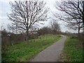
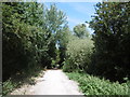
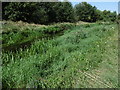
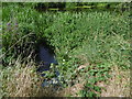
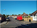
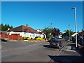
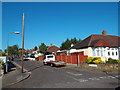
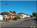
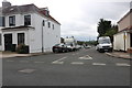
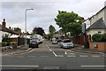
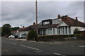
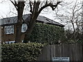
20 photos from this area
Area Information
Key information about the E11 2DB including its size, population, and administrative classification.
- Area Type
- Postcode
- Area Size
- 1.3 hectares
- Population
- 1549
- Population Density
- 4352 people/km²
House Prices in E11 2DB
39
Properties
£414,810
Average Sold Price
£121,000
Lowest Price
£743,000
Highest Price
Showing 39 properties
| Address | Type | Beds | Baths | Last Sale Price | Last Sale Date | |
|---|---|---|---|---|---|---|
| 134 Elmcroft Avenue, Wanstead, London, E11 2DB | Semi-detached | 3 | 2 | £710,000 | Mar 2025 | |
| 140 Elmcroft Avenue, Wanstead, London, E11 2DB | Semi-detached | 3 | 2 | £710,000 | Mar 2024 | |
| 130 Elmcroft Avenue, Wanstead, London, E11 2DB | Semi-detached | 3 | 1 | £712,000 | Oct 2022 | |
| 112 Elmcroft Avenue, Wanstead, London, E11 2DB | house | - | - | £625,000 | Mar 2022 | |
| 110 Elmcroft Avenue, Wanstead, London, E11 2DB | Semi-detached | 3 | 1 | £647,500 | Jul 2020 | |
| 82 Elmcroft Avenue, Wanstead, London, E11 2DB | Semi-detached | 3 | 1 | £743,000 | Nov 2018 | |
| 144 Elmcroft Avenue, Wanstead, London, E11 2DB | house | 3 | - | £592,000 | Oct 2016 | |
| 132 Elmcroft Avenue, Wanstead, London, E11 2DB | Semi-detached | 3 | 3 | £480,000 | Jan 2015 | |
| 126 Elmcroft Avenue, Wanstead, London, E11 2DB | Semi-detached | 3 | - | £485,875 | Jul 2014 | |
| 124 Elmcroft Avenue, Wanstead, London, E11 2DB | house | 3 | 1 | £499,995 | Jun 2014 |
Page 1 of 4
Energy Efficiency in E11 2DB
Amenities
Schools
| Rank | School | Type | Entry gender | Ages |
|---|
Explore more schools in this area
Go to Schools tabDemographics
Household Size
Family (3-5 people)
most common
Accommodation Type
Houses
most common
Tenure
76
majority
Ethnic Group
White
most common
Religion
N/A
most common
Household Composition
N/A
most common
Age
47
median
Adults (30-64 years)
most common
Household Deprivation
N/A
with no deprivation
NS-SEC
53
in Lower managerial occupations
Explore more demographic insights in this area
Go to Demographics tabPlanning
Planning Constraints
- Flood RiskPremium
- Ramsar Wetland SitesPremium
- Area of Outstanding Natural BeautyPremium
- Protected Nature ReservePremium
- Protected WoodlandPremium