Area Overview for E11 1AZ
Photos of E11 1AZ
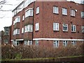
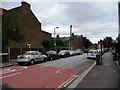
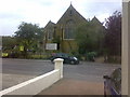
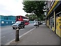
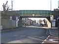
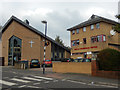
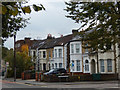

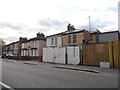
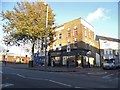
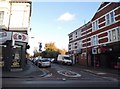
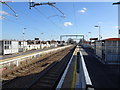
92 photos from this area
Area Information
Key information about the E11 1AZ including its size, population, and administrative classification.
- Area Type
- Postcode
- Area Size
- 8107 m²
- Population
- 1792
- Population Density
- 11828 people/km²
House Prices in E11 1AZ
14
Properties
£685,556
Average Sold Price
£270,000
Lowest Price
£1,200,000
Highest Price
Showing 14 properties
| Address | Type | Beds | Baths | Last Sale Price | Last Sale Date | |
|---|---|---|---|---|---|---|
| 40 Wallwood Road, Leytonstone, E11 1AZ | Semi-detached | 3 | 3 | £1,200,000 | Mar 2025 | |
| 66 Wallwood Road, Leytonstone, E11 1AZ | house | 4 | 1 | £910,000 | Aug 2023 | |
| 62 Wallwood Road, Leytonstone, E11 1AZ | house | - | - | £1,187,500 | Mar 2021 | |
| 52 Wallwood Road, Leytonstone, E11 1AZ | house | - | - | £868,500 | Jan 2020 | |
| 60 Wallwood Road, Leytonstone, E11 1AZ | Flat | - | - | £343,000 | Jul 2014 | |
| 56 Wallwood Road, Leytonstone, E11 1AZ | Semi-detached | - | - | £426,000 | Dec 2005 | |
| 54 Wallwood Road, Leytonstone, E11 1AZ | Detached | 5 | 3 | £380,000 | Nov 2005 | |
| 48 Wallwood Road, Leytonstone, E11 1AZ | Detached | 4 | 2 | £270,000 | Jul 2005 | |
| 68 Wallwood Road, Leytonstone, E11 1AZ | Terraced | 7 | 5 | £585,000 | Nov 2004 | |
| 42 Wallwood Road, Leytonstone, E11 1AZ | Semi-detached | 5 | 2 | - | - |
Page 1 of 2
Energy Efficiency in E11 1AZ
Amenities
Schools
| Rank | School | Type | Entry gender | Ages |
|---|
Explore more schools in this area
Go to Schools tabDemographics
Household Size
One person
most common
Accommodation Type
Flats
most common
Tenure
31
majority
Ethnic Group
White
most common
Religion
N/A
most common
Household Composition
N/A
most common
Age
47
median
Adults (30-64 years)
most common
Household Deprivation
N/A
with no deprivation
NS-SEC
38
in Lower managerial occupations
Explore more demographic insights in this area
Go to Demographics tabPlanning
Planning Constraints
- Flood RiskPremium
- Ramsar Wetland SitesPremium
- Area of Outstanding Natural BeautyPremium
- Protected Nature ReservePremium
- Protected WoodlandPremium