Area Overview for E11 1AA
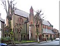
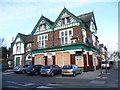
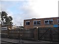
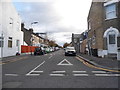
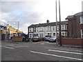
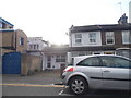
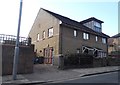
Photos of E11 1AA


Area Information
Living in E11 1AA means being part of a tightly packed residential cluster in east London, where 2,066 people reside across just 2,067 square metres. This makes it one of the most densely populated areas in England, with nearly a million people per square kilometre. The community here is predominantly adults aged 30 to 64, reflecting a mature demographic profile. Daily life is shaped by proximity to transport links and local amenities, though the small area means residents often rely on nearby districts for broader services. The postcode’s compact nature creates a sense of intimacy, but also limits the diversity of housing options. With a median age of 47, the area is home to a stable population, many of whom are likely long-term residents. The presence of multiple schools and transport hubs suggests a focus on accessibility, though the high population density may influence the pace of life. For those considering E11 1AA, understanding its constraints and conveniences is key to assessing whether it aligns with their lifestyle needs.
- Area Type
- Postcode
- Area Size
- 2067 m²
- Population
- 2066
- Population Density
- 8736 people/km²
The property market in E11 1AA is characterised by a high proportion of rented flats, with home ownership at 44%. This suggests that the area is more of a rental market than an owner-occupied one, likely due to its small size and density. The predominance of flats reflects the constraints of the postcode’s limited area, which may make larger homes or detached properties rare. For buyers, this means the available housing stock is likely to be smaller in size and focused on apartments or terraced units. The compact nature of the area also means that property values may be influenced more by proximity to transport links and schools than by individual property features. Buyers should consider whether the rental market’s dynamics align with their long-term goals, as the area’s small size may limit opportunities for property appreciation compared to larger, more diverse neighbourhoods.
House Prices in E11 1AA
Showing 2 properties
| Address | Type | Beds | Baths | Last Sale Price | Last Sale Date | |
|---|---|---|---|---|---|---|
| 81 Cambridge Park, Wanstead, London, E11 1AA | Detached | - | - | - | - | |
| 85 Cambridge Park, Wanstead, London, E11 1AA | Detached | - | - | - | - |
Energy Efficiency in E11 1AA
The lifestyle in E11 1AA is shaped by its proximity to retail and transport hubs. Within practical reach are major supermarkets like Tesco High, Iceland Leytonstone, and Sainsburys Leytonstone, offering everyday shopping convenience. The area’s rail and metro links provide easy access to nearby parks, such as Wanstead Park, and leisure opportunities. While the data does not specify dining or cultural venues, the presence of multiple transport stops suggests a network of nearby attractions. The compact nature of the area means residents often travel to adjacent districts for more extensive amenities, but the immediate vicinity supports basic needs. This balance of local convenience and broader connectivity defines the practicality of daily life in E11 1AA, where efficiency is prioritised over sprawling infrastructure.
Amenities
Schools
E11 1AA is served by several schools, including Davies Lane Primary School, which has an outstanding Ofsted rating, and George Tomlinson Primary School, rated as good. Connaught School for Girls appears twice in the data—once as a primary school and once as an academy with a good rating. This mix of primary and academy schools provides families with options, though the area’s small size means the selection is limited. The presence of two schools with good or outstanding ratings suggests that education quality is a strength, particularly for primary-level learning. However, the lack of secondary school data means families may need to look beyond E11 1AA for comprehensive schooling. For those prioritising primary education, the area offers a range of well-regarded options, but secondary schooling would require commuting to nearby districts.
| Rank | School | Type | Entry gender | Ages |
|---|
Explore more schools in this area
Go to Schools tabDemographics
The community in E11 1AA is defined by its age profile, with a median age of 47 and the majority of residents falling within the 30-64 age range. This suggests a population that is largely established, with fewer young families or retirees. Home ownership is relatively low at 44%, indicating that a significant portion of the housing stock is rented. The accommodation type is predominantly flats, which is typical for high-density urban areas. The predominant ethnic group is White, though the data does not specify further diversity metrics. The high population density—nearly a million people per square kilometre—raises practical considerations for quality of life, such as space constraints and potential pressure on local services. This demographic profile implies a community that values proximity to amenities but may face challenges related to overcrowding and limited private outdoor space.
Household Size
Accommodation Type
Tenure
Ethnic Group
Religion
Household Composition
Age
Household Deprivation
NS-SEC
Explore more demographic insights in this area
Go to Demographics tabPlanning
Planning Constraints
- Flood RiskPremium
- Ramsar Wetland SitesPremium
- Area of Outstanding Natural BeautyPremium
- Protected Nature ReservePremium
- Protected WoodlandPremium