Area Overview for E10 6PS
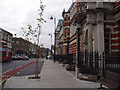
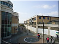
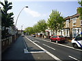
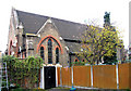
Photos of E10 6PS


Area Information
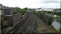
Living in E10 6PS means being part of a small, tightly knit residential cluster in east London. With a population of just 1,933, the area is compact but well-served by transport and amenities. The community here skews towards adults aged 30–64, reflecting a mature demographic that values stability. Daily life is shaped by proximity to key transport hubs, including Leyton and Leytonstone train stations, which connect residents to central London and beyond. The area’s digital infrastructure is robust, with near-perfect broadband scores and strong mobile coverage, supporting both work and leisure. While E10 6PS lacks natural landscapes or protected sites, its practicality is evident in the mix of retail, transport, and commuting options. Residents benefit from easy access to Sainsburys, Tesco, and Asda, as well as the nearby London City Airport. The area’s small size means it is not a high-density suburb, but its location near major roads and stations makes it a strategic choice for those prioritising connectivity over sprawling green spaces.
- Area Type
- Postcode
- Area Size
- Not available
- Population
- 1933
- Population Density
- 16536 people/km²
The property market in E10 6PS is characterised by a 41% home ownership rate, indicating that less than half of properties are owner-occupied. This suggests a significant portion of the housing stock is rented, possibly attracting tenants seeking stability in a low-density area. The accommodation type is predominantly houses, which is atypical for inner London, where flats dominate. This may reflect a niche market catering to those preferring single-family homes, though the small size of the area limits housing diversity. Buyers should consider the limited availability of properties and the potential for competition among buyers. The presence of houses may also mean higher price points compared to nearby rental-focused areas. Given the proximity to transport links, the area could appeal to commuters, but its small size means it is not a hub for large-scale property development.
House Prices in E10 6PS
No properties found in this postcode.
Energy Efficiency in E10 6PS
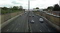
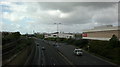
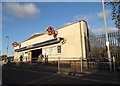
E10 6PS offers a range of amenities within practical reach, including retail outlets like Sainsburys Leyton, Tesco Leyton, and Asda Leyton, which cater to everyday shopping needs. The area’s transport links are extensive, with train stations such as Leyton Midland Road and Leytonstone High Road providing access to broader networks. The Whipps Cross Bus Interchange serves as a hub for local routes, while nearby ferry piers, including East India Pier, offer alternative travel options. Although there are no named parks or leisure facilities in the data, the proximity to London City Airport and major roads suggests a focus on practicality over recreation. The mix of retail, transport, and commuting infrastructure creates a functional lifestyle, ideal for those prioritising convenience over expansive green spaces.
Amenities
Schools
| Rank | School | Type | Entry gender | Ages |
|---|
Explore more schools in this area
Go to Schools tabDemographics
The population of E10 6PS is 1,933, with a median age of 47. This indicates a community dominated by adults in their 30s to 60s, many of whom are likely in their peak working years. Home ownership stands at 41%, suggesting a mix of owner-occupied properties and rental units. The predominant accommodation type is houses, which is unusual for inner London, hinting at a focus on family homes or larger properties. The ethnic composition is largely White, though no specific breakdown of minority groups is provided. The age range of 30–64 years suggests a stable, established population with fewer young families or retirees. This demographic profile may influence local services and amenities, which appear tailored to adults rather than children or the elderly. The lack of data on deprivation or income levels means the quality of life cannot be fully assessed, but the presence of retail and transport options implies a baseline of accessibility.
Household Size
Accommodation Type
Tenure
Ethnic Group
Religion
Household Composition
Age
Household Deprivation
NS-SEC
Explore more demographic insights in this area
Go to Demographics tabPlanning
Planning Constraints
- Flood RiskPremium
- Ramsar Wetland SitesPremium
- Area of Outstanding Natural BeautyPremium
- Protected Nature ReservePremium
- Protected WoodlandPremium