Area Overview for E10 6LN
Photos of E10 6LN
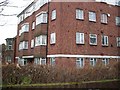
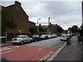
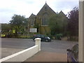


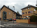
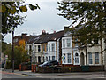

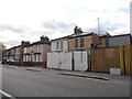
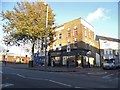
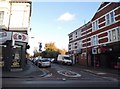

92 photos from this area
Area Information
Key information about the E10 6LN including its size, population, and administrative classification.
- Area Type
- Postcode
- Area Size
- 9691 m²
- Population
- 2105
- Population Density
- 15155 people/km²
House Prices in E10 6LN
68
Properties
£373,119
Average Sold Price
£37,500
Lowest Price
£806,500
Highest Price
Showing 68 properties
| Address | Type | Beds | Baths | Last Sale Price | Last Sale Date | |
|---|---|---|---|---|---|---|
| 85 Scotts Road, Leyton, E10 6LN | Flat | 2 | 1 | £475,000 | Nov 2025 | |
| 57 Scotts Road, Leyton, E10 6LN | Terraced | 4 | 2 | £515,000 | Apr 2025 | |
| 25 Scotts Road, Leyton, E10 6LN | Flat | 2 | 1 | £480,000 | Mar 2025 | |
| 95 Scotts Road, Leyton, E10 6LN | Flat | 2 | 1 | £530,000 | Dec 2024 | |
| 65 Scotts Road, Leyton, E10 6LN | Maisonette | 3 | 1 | £563,785 | Dec 2024 | |
| 71 Scotts Road, Leyton, E10 6LN | Flat | 2 | 1 | £538,500 | Nov 2024 | |
| 79 Scotts Road, Leyton, E10 6LN | Terraced | 3 | 1 | £625,000 | Dec 2023 | |
| 107 Scotts Road, Leyton, E10 6LN | Flat | - | - | £265,000 | Jun 2023 | |
| 33 Scotts Road, Leyton, E10 6LN | Maisonette | 2 | 1 | £511,000 | Feb 2023 | |
| 67 Scotts Road, Leyton, E10 6LN | Flat | 2 | 1 | £505,250 | Aug 2022 |
Page 1 of 7
Energy Efficiency in E10 6LN
Amenities
Schools
| Rank | School | Type | Entry gender | Ages |
|---|
Explore more schools in this area
Go to Schools tabDemographics
Household Size
Family (3-5 people)
most common
Accommodation Type
Flats
most common
Tenure
54
majority
Ethnic Group
White
most common
Religion
N/A
most common
Household Composition
N/A
most common
Age
47
median
Adults (30-64 years)
most common
Household Deprivation
N/A
with no deprivation
NS-SEC
43
in Lower managerial occupations
Explore more demographic insights in this area
Go to Demographics tabPlanning
Planning Constraints
- Flood RiskPremium
- Ramsar Wetland SitesPremium
- Area of Outstanding Natural BeautyPremium
- Protected Nature ReservePremium
- Protected WoodlandPremium