Area Overview for E10 5QA
Photos of E10 5QA
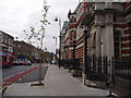
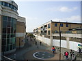
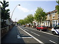
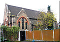


100 photos from this area
Area Information
Key information about the E10 5QA including its size, population, and administrative classification.
- Area Type
- Postcode
- Area Size
- 1.1 hectares
- Population
- 1891
- Population Density
- 17381 people/km²
House Prices in E10 5QA
77
Properties
£372,921
Average Sold Price
£58,000
Lowest Price
£1,020,000
Highest Price
Showing 77 properties
| Address | Type | Beds | Baths | Last Sale Price | Last Sale Date | |
|---|---|---|---|---|---|---|
| 40 Warren Road, Leyton, E10 5QA | Terraced | 3 | 2 | £655,000 | Aug 2025 | |
| 84 Warren Road, Leyton, E10 5QA | Terraced | 5 | 3 | £847,500 | Feb 2025 | |
| 94 Warren Road, Leyton, E10 5QA | Flat | - | - | £420,000 | Oct 2023 | |
| 106 Warren Road, Leyton, E10 5QA | Terraced | 5 | 2 | £1,020,000 | Aug 2022 | |
| 60 Warren Road, Leyton, E10 5QA | house | 3 | 1 | £703,000 | Jun 2021 | |
| 88 Warren Road, Leyton, E10 5QA | Terraced | 4 | - | £560,000 | Apr 2018 | |
| 66 Warren Road, Leyton, E10 5QA | house | 3 | - | £560,000 | Sep 2015 | |
| 96 Warren Road, Leyton, E10 5QA | house | - | - | £400,000 | Jan 2013 | |
| 16 Warren Road, Leyton, E10 5QA | house | - | - | £285,000 | Mar 2011 | |
| 68 Warren Road, Leyton, E10 5QA | house | 6 | - | £399,995 | Sep 2010 |
Page 1 of 8
Energy Efficiency in E10 5QA
Amenities
Schools
| Rank | School | Type | Entry gender | Ages |
|---|
Explore more schools in this area
Go to Schools tabDemographics
Household Size
Family (3-5 people)
most common
Accommodation Type
Houses
most common
Tenure
39
majority
Ethnic Group
White
most common
Religion
N/A
most common
Household Composition
N/A
most common
Age
47
median
Adults (30-64 years)
most common
Household Deprivation
N/A
with no deprivation
NS-SEC
32
in Lower managerial occupations
Explore more demographic insights in this area
Go to Demographics tabPlanning
Planning Constraints
- Flood RiskPremium
- Ramsar Wetland SitesPremium
- Area of Outstanding Natural BeautyPremium
- Protected Nature ReservePremium
- Protected WoodlandPremium