Area Overview for E10 5DN
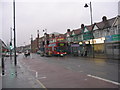
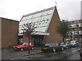
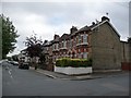
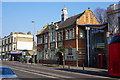
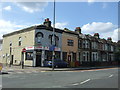
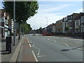
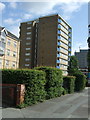
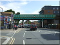
Photos of E10 5DN


Area Information
Living in E10 5DN means inhabiting a densely populated, compact residential cluster in east London. The area covers just 3,919 square metres, yet it holds 1,932 residents, translating to a population density of nearly 493,000 people per square kilometre. This makes it one of the most densely inhabited places in the UK. The community is predominantly composed of adults aged 30–64, with a median age of 47. Daily life here is shaped by proximity to amenities, including multiple schools, transport hubs, and retail outlets. The area’s small size means residents are within walking or short-vehicle distance of essential services. While the high density may feel urban, the presence of local schools and green spaces suggests a balance between convenience and livability. For those seeking a compact, well-connected neighbourhood with access to both city infrastructure and suburban comfort, E10 5DN offers a unique blend of practicality and proximity.
- Area Type
- Postcode
- Area Size
- 3919 m²
- Population
- 1932
- Population Density
- 10309 people/km²
The property market in E10 5DN is characterised by a 53% home ownership rate, with houses being the predominant accommodation type. This suggests a market skewed towards owner-occupied properties rather than a high proportion of rentals. The small area size—just 3,919 square metres—means housing stock is limited, likely comprising a mix of older and newer homes. Given the high population density, properties may be smaller or more tightly spaced than in surrounding areas. For buyers, this compactness could mean competition for available homes, particularly given the proximity to transport and schools. The lack of flats implies a focus on single-family or semi-detached housing, which may appeal to those seeking privacy or space. However, the limited land area means expansion is unlikely, making the market potentially stable but with limited new supply.
House Prices in E10 5DN
Showing 2 properties
| Address | Type | Beds | Baths | Last Sale Price | Last Sale Date | |
|---|---|---|---|---|---|---|
| George Mitchell Secondary School, 2A Farmer Road, Leyton, E10 5DN | commercial | - | - | - | - | |
| School Kitchen, George Mitchell Secondary School, 2A Farmer Road, Leyton, E10 5DN | commercial | - | - | - | - |
Energy Efficiency in E10 5DN
Residents of E10 5DN have access to a range of amenities within walking or short-vehicle distance. Retail options include Sainsburys Leyton, Tesco Lea, and Tesco Leyton, providing everyday shopping needs. The area’s transport hubs—such as Leytonstone High Road Station and Snaresbrook Station—connect to wider London, while nearby ferry piers offer river access. Though specific parks or leisure facilities are not listed in the data, the proximity to Leyton and Leytonstone suggests potential green spaces. The presence of multiple schools and transport links indicates a community focused on convenience, with services clustered to meet daily demands. This density may foster a vibrant, active lifestyle, though it also means limited space for expansive recreational areas.
Amenities
Schools
Residents of E10 5DN have access to three schools within practical reach. The Beaumont School is a primary institution, while George Mitchell School serves as both a primary and an academy with a ‘good’ Ofsted rating. The presence of two primary schools and an academy suggests a range of educational options for families, from early years to secondary-level provision. The academy’s ‘good’ rating indicates a school that meets national standards, though it does not achieve the highest possible classification. This mix of school types may cater to different preferences, whether prioritising traditional primary education or the structured approach of an academy. For parents, the proximity of these schools—within walking distance for many—reduces the need for long commutes, enhancing the area’s appeal for families.
| Rank | School | Type | Entry gender | Ages |
|---|
Explore more schools in this area
Go to Schools tabDemographics
The community in E10 5DN is predominantly middle-aged, with a median age of 47 and the majority of residents falling within the 30–64 age range. Home ownership stands at 53%, indicating a mix of owner-occupied and rental properties. The area is primarily composed of houses rather than flats, reflecting a preference for standalone living. The predominant ethnic group is White, though specific data on diversity is not provided. The high population density—nearly 500,000 people per square kilometre—suggests a tightly packed, possibly multi-generational community. This density may influence local dynamics, such as shared amenities and communal spaces. The age profile suggests a stable population with established households, which could contribute to a cohesive, long-term community feel. However, the lack of detailed diversity statistics means broader demographic nuances remain unexplored.
Household Size
Accommodation Type
Tenure
Ethnic Group
Religion
Household Composition
Age
Household Deprivation
NS-SEC
Explore more demographic insights in this area
Go to Demographics tabPlanning
Planning Constraints
- Flood RiskPremium
- Ramsar Wetland SitesPremium
- Area of Outstanding Natural BeautyPremium
- Protected Nature ReservePremium
- Protected WoodlandPremium