Area Overview for E10 5BY
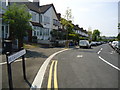
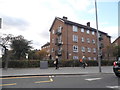
Photos of E10 5BY


Area Information
E10 5BY is a compact residential cluster in east London, spanning just 6.6 hectares. With a population of 1,832, it is densely populated, at 27,569 people per square kilometre, reflecting a tightly knit community. This area is defined by its proximity to key transport hubs and retail centres, making it a practical choice for those prioritising connectivity. The demographic profile suggests a mature population, with a median age of 47 and the majority of residents aged 30–64. Daily life here is shaped by the mix of local shops, public transport, and the surrounding urban infrastructure. While the area is small, its strategic location near Leyton and Stratford offers access to broader amenities. The high population density means living spaces are closely packed, which can influence the character of the neighbourhood. For those seeking a balance between urban convenience and a sense of community, E10 5BY presents a distinct proposition.
- Area Type
- Postcode
- Area Size
- 6.6 hectares
- Population
- 1832
- Population Density
- 3446 people/km²
The property market in E10 5BY is characterised by a low home ownership rate of 36%, suggesting that most residents are renters rather than homeowners. The accommodation type is predominantly flats, which aligns with the area’s small size and high density. This suggests a housing stock that is largely purpose-built for urban living, with limited scope for larger properties or family homes. For buyers considering the area, the small footprint of E10 5BY means the housing options are constrained, and proximity to nearby amenities such as Leyton and Stratford is likely a key factor in property value. The prevalence of flats may appeal to those seeking low-maintenance living, but it also limits opportunities for expansion or renovation. Given the high population density, properties here are likely to be in high demand, particularly for those prioritising convenience over space.
House Prices in E10 5BY
Showing 2 properties
| Address | Type | Beds | Baths | Last Sale Price | Last Sale Date | |
|---|---|---|---|---|---|---|
| Bywaters Leyton Ltd, Gateway Road, Leyton, E10 5BY | shop | - | - | - | - | |
| Gateway Road Recycling Centre, Gateway Road, Leyton, E10 5BY | commercial | - | - | - | - |
Energy Efficiency in E10 5BY
Living in E10 5BY offers access to a range of essential amenities within walking or short-vehicle distance. The area is served by major supermarkets such as Sainsburys Leyton, Asda Leyton, and Tesco Leyton, ensuring convenience for daily shopping. Public transport is extensive, with metro stations like Leyton and Stratford High Street, rail services at Leyton Midland Road and Stratford International, and the Whipps Cross Bus Interchange providing connectivity. For those near the Thames, ferry piers at East India and Canary Wharf are accessible, though these are more suited to occasional use. The proximity to London City Airport adds to the area’s appeal for professionals in aviation or finance. While the area lacks large parks or green spaces, its compact design prioritises accessibility to urban amenities, making it ideal for those who value convenience over expansive outdoor areas.
Amenities
Schools
| Rank | School | Type | Entry gender | Ages |
|---|
Explore more schools in this area
Go to Schools tabDemographics
The community in E10 5BY is predominantly composed of adults aged 30–64, with a median age of 47. Home ownership is relatively low at 36%, indicating that a significant portion of the population rents their homes. The accommodation type is primarily flats, reflecting the area’s compact size and density. The predominant ethnic group is White, though specific data on diversity beyond this is not provided. The high population density of 27,569 people per square kilometre suggests a mix of long-term residents and those living in shared or smaller households. This demographic profile implies a stable, middle-aged population likely focused on practical living needs. The lack of detailed diversity statistics means the full range of cultural or social dynamics is not quantified, but the data highlights a community shaped by proximity to transport and retail rather than expansive green spaces.
Household Size
Accommodation Type
Tenure
Ethnic Group
Religion
Household Composition
Age
Household Deprivation
NS-SEC
Explore more demographic insights in this area
Go to Demographics tabPlanning
Planning Constraints
- Flood RiskPremium
- Ramsar Wetland SitesPremium
- Area of Outstanding Natural BeautyPremium
- Protected Nature ReservePremium
- Protected WoodlandPremium