Area Overview for E1 4UJ
Photos of E1 4UJ
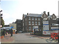

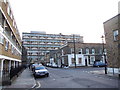
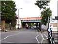
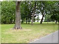


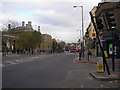

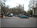


100 photos from this area
Area Information
Key information about the E1 4UJ including its size, population, and administrative classification.
- Area Type
- Postcode
- Area Size
- 1.1 hectares
- Population
- 1978
- Population Density
- 12225 people/km²
House Prices in E1 4UJ
29
Properties
£620,750
Average Sold Price
£149,000
Lowest Price
£1,550,000
Highest Price
Showing 29 properties
| Address | Type | Beds | Baths | Last Sale Price | Last Sale Date | |
|---|---|---|---|---|---|---|
| 109 Mile End Road, London, E1 4UJ | Terraced | 4 | 2 | £1,550,000 | Dec 2021 | |
| 113 Mile End Road, London, E1 4UJ | Terraced | - | - | £635,000 | Sep 2005 | |
| 107 Mile End Road, London, E1 4UJ | house | 3 | 1 | £149,000 | Oct 1997 | |
| 111 Mile End Road, London, E1 4UJ | Terraced | 5 | 2 | £149,000 | Apr 1995 | |
| 91 Mile End Road, London, E1 4UJ | commercial | - | - | - | - | |
| 129 Mile End Road, London, E1 4UJ | Office | - | - | - | - | |
| Unit 1, Anchor Retail Park, Mile End Road, London, E1 4UJ | Retail | - | - | - | - | |
| 123-125 Mile End Road, London, E1 4UJ | retail_financial | - | - | - | - | |
| Unit B14, 129 Mile End Road, London, E1 4UJ | Office | - | - | - | - | |
| Unit B19, 129 Mile End Road, London, E1 4UJ | Office | - | - | - | - |
Page 1 of 3
Energy Efficiency in E1 4UJ
Amenities
Schools
| Rank | School | Type | Entry gender | Ages |
|---|
Explore more schools in this area
Go to Schools tabDemographics
Household Size
Two person
most common
Accommodation Type
Flats
most common
Tenure
25
majority
Ethnic Group
White
most common
Religion
N/A
most common
Household Composition
N/A
most common
Age
22
median
Adults (30-64 years)
most common
Household Deprivation
N/A
with no deprivation
NS-SEC
41
in Lower managerial occupations
Explore more demographic insights in this area
Go to Demographics tabPlanning
Planning Constraints
- Flood RiskPremium
- Ramsar Wetland SitesPremium
- Area of Outstanding Natural BeautyPremium
- Protected Nature ReservePremium
- Protected WoodlandPremium