Area Overview for E1 4EP
Photos of E1 4EP
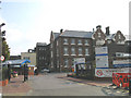
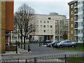
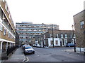
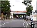
100 photos from this area
Area Information
Key information about the E1 4EP including its size, population, and administrative classification.
- Area Type
- Postcode
- Area Size
- 4041 m²
- Population
- 1381
- Population Density
- 16945 people/km²
House Prices in E1 4EP
20
Properties
£300,409
Average Sold Price
£188,000
Lowest Price
£495,000
Highest Price
Showing 20 properties
| Address | Type | Beds | Baths | Last Sale Price | Last Sale Date | |
|---|---|---|---|---|---|---|
| 9 Massingham Street, London, E1 4EP | Maisonette | 4 | 2 | £495,000 | Mar 2025 | |
| 21 Massingham Street, London, E1 4EP | Maisonette | 3 | 1 | £420,000 | Mar 2025 | |
| 23 Massingham Street, London, E1 4EP | Maisonette | 3 | 1 | £405,000 | Sep 2022 | |
| 13 Massingham Street, London, E1 4EP | Maisonette | - | - | £456,000 | Aug 2017 | |
| 25 Massingham Street, London, E1 4EP | Flat | 3 | 1 | £250,000 | Apr 2011 | |
| 19 Massingham Street, London, E1 4EP | Maisonette | - | - | £249,995 | Feb 2011 | |
| 7 Massingham Street, London, E1 4EP | Flat | 4 | 1 | £225,000 | Oct 2006 | |
| 5 Massingham Street, London, E1 4EP | Maisonette | 1 | 1 | £218,000 | Aug 2006 | |
| 33 Massingham Street, London, E1 4EP | Maisonette | 3 | 1 | £197,500 | Jul 2005 | |
| 1 Massingham Street, London, E1 4EP | Maisonette | 2 | 1 | £200,000 | Dec 2004 |
Page 1 of 2
Energy Efficiency in E1 4EP
Amenities
Schools
| Rank | School | Type | Entry gender | Ages |
|---|
Explore more schools in this area
Go to Schools tabDemographics
Household Size
Family (3-5 people)
most common
Accommodation Type
Flats
most common
Tenure
15
majority
Ethnic Group
asian_total
most common
Religion
N/A
most common
Household Composition
N/A
most common
Age
47
median
Adults (30-64 years)
most common
Household Deprivation
N/A
with no deprivation
NS-SEC
23
in Lower managerial occupations
Explore more demographic insights in this area
Go to Demographics tabPlanning
Planning Constraints
- Flood RiskPremium
- Ramsar Wetland SitesPremium
- Area of Outstanding Natural BeautyPremium
- Protected Nature ReservePremium
- Protected WoodlandPremium