Area Overview for E1 0NL
Photos of E1 0NL
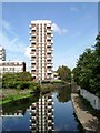
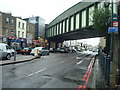
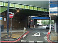
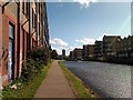


100 photos from this area
Area Information
Key information about the E1 0NL including its size, population, and administrative classification.
- Area Type
- Postcode
- Area Size
- 9932 m²
- Population
- Not available
- Population Density
- Not available
House Prices in E1 0NL
20
Properties
£703,833
Average Sold Price
£113,000
Lowest Price
£1,000,000
Highest Price
Showing 20 properties
| Address | Type | Beds | Baths | Last Sale Price | Last Sale Date | |
|---|---|---|---|---|---|---|
| 115 White Horse Road, London, E1 0NL | Detached | 2 | 2 | £952,000 | Sep 2025 | |
| 113 White Horse Road, London, E1 0NL | Retail | 3 | 2 | £858,000 | Apr 2022 | |
| 111 White Horse Road, London, E1 0NL | Terraced | 1 | 1 | £800,000 | Dec 2020 | |
| 131 White Horse Road, London, E1 0NL | Detached | 3 | 2 | £1,000,000 | Jul 2016 | |
| 96 White Horse Road, London, E1 0NL | Terraced | 3 | 2 | £500,000 | Nov 2012 | |
| 125 White Horse Road, London, E1 0NL | Terraced | - | - | £113,000 | Jun 1997 | |
| 133 White Horse Road, London, E1 0NL | Terraced | 1 | 1 | - | - | |
| 109 White Horse Road, London, E1 0NL | Terraced | - | - | - | - | |
| 129 White Horse Road, London, E1 0NL | Terraced | - | - | - | - | |
| 123 White Horse Road, London, E1 0NL | Terraced | - | - | - | - |
Page 1 of 2
Energy Efficiency in E1 0NL
Amenities
Schools
| Rank | School | Type | Entry gender | Ages |
|---|
Explore more schools in this area
Go to Schools tabDemographics
Household Size
Family (3-5 people)
most common
Accommodation Type
Flats
most common
Tenure
23
majority
Ethnic Group
asian_total
most common
Religion
N/A
most common
Household Composition
N/A
most common
Age
47
median
Adults (30-64 years)
most common
Household Deprivation
N/A
with no deprivation
NS-SEC
30
in Lower managerial occupations
Explore more demographic insights in this area
Go to Demographics tabPlanning
Planning Constraints
- Flood RiskPremium
- Ramsar Wetland SitesPremium
- Area of Outstanding Natural BeautyPremium
- Protected Nature ReservePremium
- Protected WoodlandPremium