Area Overview for Deptford Ward
Photos of Deptford Ward
Area Information
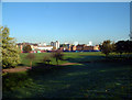
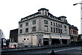
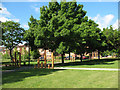
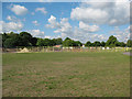
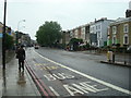
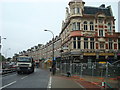
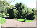
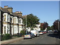
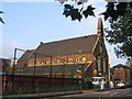
Deptford Ward sits on the south bank of the River Thames, straddling the boundary between the Royal Borough of Greenwich and the London Borough of Lewisham. This district borough unitary ward covers an area of just 1.3 square kilometres yet houses a population of 3,733 people. The geography reflects its layered history, where an ancient ford over the River Ravensbourne met a fishing village on the Thames. This unity began with royal dock development that transformed two separate communities into a single administrative entity. You are looking at a location with foundational historical sites like the former Deptford Dockyard and the Pepys Estate, which anchor the local identity. The area represents a specific slice of London where the past informs the present, situated approximately at coordinate 51.4786°N, -0.0312°W. Living in Deptford Ward means occupying a space where maritime history meets modern urban density. The small footprint combined with a significant population creates an intense environment compared to wider boroughs. You navigate an area that has evolved from Elizabethan wood yards to a compact residential ward. Understanding this background helps explain why the community feels so established yet distinct from neighbouring zones. The physical layout supports a lifestyle where residents live close to water and historic landmarks while navigating a densely populated district.
- Area Type
- District Borough Unitary Ward
- Area Size
- 1.3 km²
- Population
- 3733
- Population Density
- 2876 people/km²
Demographics
The community within Deptford Ward exhibits a distinct age profile with a median age of 70 years. Statistics indicate that the age range data is captured as Total, suggesting a population heavily weighted toward older residents. Home ownership presents a specific dynamic here, with only 24 per cent of homes currently owned outright or mortgaged by residents. This low retention rate implies a high concentration of renters within the ward. You are entering a market where long-term tenancy likely dominates the neighbourhood fabric. Household composition and accommodation type data are recorded as total categories, confirming the need to look at aggregate figures for planning purposes. The absence of granular breakdowns for ethnic groups or religious affiliations in the available records means broad demographic statements are limited. You cannot define the area's diversity from current datasets, so you must focus on the clear age and ownership metrics. Over two-thirds of the population relies on the rental sector rather than owning their dwelling. This reality shapes the local social contract and property transactions you might consider. A third of the living space belongs to people who do not hold titles to their residences. When viewing homes in Deptford Ward, you should factor in the high probability of dealing with landlords or rental agencies rather than private sellers. The high median age combined with low ownership suggests a retirement demographic supported by a larger transient workforce.
Household Size
Accommodation Type
Tenure
Ethnic Group
Religion
Household Composition
Age
Household Deprivation
NS-SEC
Explore more demographic insights in this area
Go to Demographics tabPlanning
Planning Constraints
- Flood RiskPremium
- Ramsar Wetland SitesPremium
- Area of Outstanding Natural BeautyPremium
- Protected Nature ReservePremium
- Protected WoodlandPremium
- Crime RiskPremium