Area Overview for DA8 3RZ
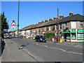
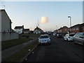
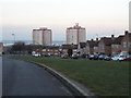
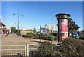
Photos of DA8 3RZ


Area Information
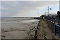
DA8 3RZ is a small residential cluster in England’s southeast, nestled within the historic town of Erith on the River Thames’ south bank. With a population of 1,325, it reflects a compact, tightly knit community shaped by its Saxon origins and later industrial history. The area’s proximity to London’s transport networks and amenities makes it a practical choice for commuters and those seeking a balance between suburban living and urban access. Residents benefit from nearby rail links, including Erith and Slade Green stations, which connect to London’s broader network. The area’s character is defined by its riverside heritage, with remnants of 16th-century naval dockyards and Victorian architecture still visible. While the population is relatively young, with a median age of 22, the most common age group is adults aged 30–64, suggesting a mix of families and professionals. Living here means navigating a small, manageable community with direct access to retail, transport, and historical sites, though its size means services are focused and local.
- Area Type
- Postcode
- Area Size
- Not available
- Population
- Not available
- Population Density
- Not available
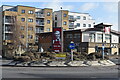
The property market in DA8 3RZ is characterised by a 45% home ownership rate, indicating a majority rental market. Flats dominate the accommodation type, which aligns with the area’s compact size and likely focus on high-density housing. This suggests a housing stock that prioritises affordability and efficiency, appealing to renters, particularly younger professionals or families seeking smaller, manageable spaces. The small postcode area means the market is limited in scale, with limited scope for property diversity. Buyers should consider the area’s proximity to transport links, such as Erith and Slade Green stations, which enhance its appeal for commuters. However, the concentration of flats may limit options for those seeking larger homes. For those considering purchase, the rental market’s dynamics and the area’s historical infrastructure could influence long-term value, though the small size of DA8 3RZ means broader trends in the surrounding region may have a stronger impact.
House Prices in DA8 3RZ
No properties found in this postcode.
Energy Efficiency in DA8 3RZ
Daily life in DA8 3RZ is shaped by its proximity to retail, transport, and historical sites. Residents have access to five retail outlets within practical reach, including Tesco Erith, Farmfoods Erith, and Iceland Erith, ensuring convenience for grocery shopping. The area’s rail network, with stations like Erith and Slade Green, offers direct links to London, while ferry piers provide scenic river travel. The nearby Erith railway station, built in 1849, is a historic landmark, and the town’s riverside heritage adds a unique character. Parks and open spaces are less explicitly detailed, but the area’s historical sites, such as the former naval dockyard, suggest opportunities for leisure. The mix of retail, transport, and historical features creates a lifestyle that balances practicality with a touch of local history, making it appealing to those who value accessibility and a sense of place.
Amenities
Schools
| Rank | School | Type | Entry gender | Ages |
|---|
Explore more schools in this area
Go to Schools tabDemographics
The demographic profile of DA8 3RZ reveals a community where 45% of homes are owner-occupied, with the remaining 55% likely rented. The accommodation type is predominantly flats, reflecting a housing stock suited to smaller households or couples. The median age of 22 contrasts with the most common age range of 30–64 years, indicating a mix of younger residents and older adults, possibly due to student populations or workforce demographics. The predominant ethnic group is White, though no specific diversity statistics are provided. The area’s relatively low population density and focus on flats suggest a community oriented towards affordability and practical living. For quality of life, the 45% home ownership rate implies a rental market that may influence housing availability and competition. The absence of detailed deprivation data means the area’s economic challenges remain unquantified, but the presence of retail and transport links suggests basic needs are met.
Household Size
Accommodation Type
Tenure
Ethnic Group
Religion
Household Composition
Age
Household Deprivation
NS-SEC
Explore more demographic insights in this area
Go to Demographics tabPlanning
Planning Constraints
- Flood RiskPremium
- Ramsar Wetland SitesPremium
- Area of Outstanding Natural BeautyPremium
- Protected Nature ReservePremium
- Protected WoodlandPremium