Area Overview for DA8 3LT
Photos of DA8 3LT

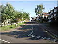
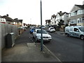


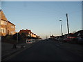
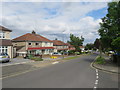


31 photos from this area
Area Information
Key information about the DA8 3LT including its size, population, and administrative classification.
- Area Type
- Postcode
- Area Size
- 8548 m²
- Population
- 1558
- Population Density
- 4784 people/km²
House Prices in DA8 3LT
34
Properties
£197,875
Average Sold Price
£65,000
Lowest Price
£430,000
Highest Price
Showing 34 properties
| Address | Type | Beds | Baths | Last Sale Price | Last Sale Date | |
|---|---|---|---|---|---|---|
| 397 Erith Road, Erith, DA8 3LT | Semi-detached | 3 | 1 | £430,000 | Nov 2024 | |
| 423 Erith Road, Erith, DA8 3LT | Flat | 2 | 1 | £240,000 | Oct 2024 | |
| 431 Erith Road, Erith, DA8 3LT | Flat | - | - | £257,000 | Nov 2021 | |
| 411 Erith Road, Erith, DA8 3LT | Terraced | 3 | 1 | £357,500 | Nov 2021 | |
| 445 Erith Road, Erith, DA8 3LT | Flat | - | - | £185,000 | Jun 2021 | |
| 387 Erith Road, Erith, DA8 3LT | Semi-detached | - | - | £430,000 | Apr 2021 | |
| 419 Erith Road, Erith, DA8 3LT | Flat | 3 | 1 | £194,000 | Mar 2021 | |
| 429 Erith Road, Erith, DA8 3LT | Flat | - | - | £235,000 | Mar 2021 | |
| 413 Erith Road, Erith, DA8 3LT | house | 3 | - | £345,000 | Dec 2020 | |
| 437 Erith Road, Erith, DA8 3LT | Flat | - | - | £235,000 | Nov 2020 |
Page 1 of 4
Energy Efficiency in DA8 3LT
Amenities
Schools
| Rank | School | Type | Entry gender | Ages |
|---|
Explore more schools in this area
Go to Schools tabDemographics
Household Size
Family (3-5 people)
most common
Accommodation Type
Houses
most common
Tenure
81
majority
Ethnic Group
White
most common
Religion
N/A
most common
Household Composition
N/A
most common
Age
47
median
Adults (30-64 years)
most common
Household Deprivation
N/A
with no deprivation
NS-SEC
38
in Lower managerial occupations
Explore more demographic insights in this area
Go to Demographics tabPlanning
Planning Constraints
- Flood RiskPremium
- Ramsar Wetland SitesPremium
- Area of Outstanding Natural BeautyPremium
- Protected Nature ReservePremium
- Protected WoodlandPremium