Area Overview for DA8 2JN
Photos of DA8 2JN
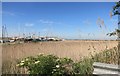
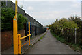
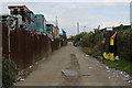
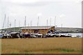
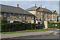
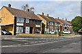

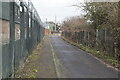
52 photos from this area
Area Information
Key information about the DA8 2JN including its size, population, and administrative classification.
- Area Type
- Postcode
- Area Size
- 9229 m²
- Population
- 2050
- Population Density
- 1355 people/km²
House Prices in DA8 2JN
30
Properties
£261,785
Average Sold Price
£96,000
Lowest Price
£412,500
Highest Price
Showing 30 properties
| Address | Type | Beds | Baths | Last Sale Price | Last Sale Date | |
|---|---|---|---|---|---|---|
| 274 Slade Green Road, Erith, DA8 2JN | Semi-detached | 3 | 1 | £412,500 | Jun 2023 | |
| 246 Slade Green Road, Erith, DA8 2JN | Semi-detached | 3 | 1 | £380,000 | Dec 2022 | |
| 268 Slade Green Road, Erith, DA8 2JN | Retail | 3 | 1 | £385,000 | Sep 2022 | |
| 272 Slade Green Road, Erith, DA8 2JN | Semi-detached | 3 | 2 | £355,000 | Sep 2021 | |
| 266 Slade Green Road, Erith, DA8 2JN | Terraced | 3 | 1 | £325,000 | Jun 2021 | |
| 270 Slade Green Road, Erith, DA8 2JN | house | - | - | £325,000 | Oct 2020 | |
| 254 Slade Green Road, Erith, DA8 2JN | Semi-detached | 3 | 1 | £335,000 | Nov 2019 | |
| 232 Slade Green Road, Erith, DA8 2JN | Semi-detached | 3 | - | £287,000 | Oct 2016 | |
| 256 Slade Green Road, Erith, DA8 2JN | house | 3 | - | £183,000 | Jul 2011 | |
| 244 Slade Green Road, Erith, DA8 2JN | Semi-detached | - | - | £174,500 | Dec 2004 |
Page 1 of 3
Energy Efficiency in DA8 2JN
Amenities
Schools
| Rank | School | Type | Entry gender | Ages |
|---|
Explore more schools in this area
Go to Schools tabDemographics
Household Size
Family (3-5 people)
most common
Accommodation Type
Houses
most common
Tenure
64
majority
Ethnic Group
White
most common
Religion
N/A
most common
Household Composition
N/A
most common
Age
47
median
Adults (30-64 years)
most common
Household Deprivation
N/A
with no deprivation
NS-SEC
30
in Lower managerial occupations
Explore more demographic insights in this area
Go to Demographics tabPlanning
Planning Constraints
- Flood RiskPremium
- Ramsar Wetland SitesPremium
- Area of Outstanding Natural BeautyPremium
- Protected Nature ReservePremium
- Protected WoodlandPremium