Area Overview for DA8 2HH
Photos of DA8 2HH

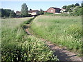

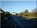


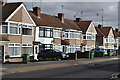


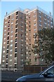
32 photos from this area
Area Information
Key information about the DA8 2HH including its size, population, and administrative classification.
- Area Type
- Postcode
- Area Size
- 4463 m²
- Population
- 1957
- Population Density
- 6289 people/km²
House Prices in DA8 2HH
19
Properties
£196,966
Average Sold Price
£84,500
Lowest Price
£388,000
Highest Price
Showing 19 properties
| Address | Type | Beds | Baths | Last Sale Price | Last Sale Date | |
|---|---|---|---|---|---|---|
| 31 Peareswood Road, Erith, DA8 2HH | Terraced | 3 | 1 | £388,000 | May 2024 | |
| 1 Peareswood Road, Erith, DA8 2HH | Terraced | 3 | 1 | £219,500 | Jan 2024 | |
| 15 Peareswood Road, Erith, DA8 2HH | Terraced | 2 | 1 | £315,000 | Oct 2023 | |
| 25 Peareswood Road, Erith, DA8 2HH | Terraced | 2 | 1 | £279,995 | Oct 2018 | |
| 7 Peareswood Road, Erith, DA8 2HH | Terraced | 3 | 1 | £200,000 | Sep 2015 | |
| 3 Peareswood Road, Erith, DA8 2HH | Terraced | 3 | - | £150,000 | May 2013 | |
| 9 Peareswood Road, Erith, DA8 2HH | house | - | - | £150,000 | Apr 2013 | |
| 23 Peareswood Road, Erith, DA8 2HH | Terraced | - | - | £179,000 | Feb 2008 | |
| 19 Peareswood Road, Erith, DA8 2HH | house | 2 | - | £154,000 | Sep 2007 | |
| 29 Peareswood Road, Erith, DA8 2HH | Terraced | - | - | £240,000 | May 2007 |
Page 1 of 2
Energy Efficiency in DA8 2HH
Amenities
Schools
| Rank | School | Type | Entry gender | Ages |
|---|
Explore more schools in this area
Go to Schools tabDemographics
Household Size
Family (3-5 people)
most common
Accommodation Type
Houses
most common
Tenure
41
majority
Ethnic Group
White
most common
Religion
N/A
most common
Household Composition
N/A
most common
Age
47
median
Adults (30-64 years)
most common
Household Deprivation
N/A
with no deprivation
NS-SEC
20
in Lower managerial occupations
Explore more demographic insights in this area
Go to Demographics tabPlanning
Planning Constraints
- Flood RiskPremium
- Ramsar Wetland SitesPremium
- Area of Outstanding Natural BeautyPremium
- Protected Nature ReservePremium
- Protected WoodlandPremium