Area Overview for DA8 2HF
Photos of DA8 2HF
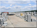
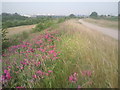
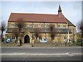
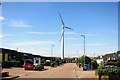
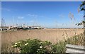
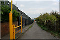
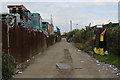
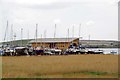
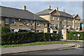
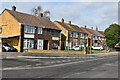

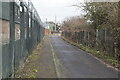
52 photos from this area
Area Information
Key information about the DA8 2HF including its size, population, and administrative classification.
- Area Type
- Postcode
- Area Size
- 3830 m²
- Population
- 2050
- Population Density
- 1355 people/km²
House Prices in DA8 2HF
19
Properties
£164,895
Average Sold Price
£56,000
Lowest Price
£220,500
Highest Price
Showing 19 properties
| Address | Type | Beds | Baths | Last Sale Price | Last Sale Date | |
|---|---|---|---|---|---|---|
| 87 Canada Road, Erith, DA8 2HF | Flat | 2 | 1 | £220,000 | Oct 2024 | |
| 79 Canada Road, Erith, DA8 2HF | Flat | 2 | 1 | £220,000 | May 2024 | |
| 73 Canada Road, Erith, DA8 2HF | Flat | - | - | £220,500 | Jun 2022 | |
| 89 Canada Road, Erith, DA8 2HF | Flat | 2 | 1 | £196,000 | Jan 2021 | |
| 81 Canada Road, Erith, DA8 2HF | Flat | - | - | £190,000 | Feb 2020 | |
| 61 Canada Road, Erith, DA8 2HF | Flat | - | - | £160,000 | Jun 2019 | |
| 95 Canada Road, Erith, DA8 2HF | Flat | 1 | - | £155,000 | Dec 2018 | |
| 93 Canada Road, Erith, DA8 2HF | Flat | 1 | - | £167,000 | Aug 2017 | |
| 71 Canada Road, Erith, DA8 2HF | Flat | - | - | £193,500 | Nov 2016 | |
| 63 Canada Road, Erith, DA8 2HF | Flat | - | - | £170,000 | Jul 2016 |
Page 1 of 2
Energy Efficiency in DA8 2HF
Amenities
Schools
| Rank | School | Type | Entry gender | Ages |
|---|
Explore more schools in this area
Go to Schools tabDemographics
Household Size
Family (3-5 people)
most common
Accommodation Type
Houses
most common
Tenure
64
majority
Ethnic Group
White
most common
Religion
N/A
most common
Household Composition
N/A
most common
Age
47
median
Adults (30-64 years)
most common
Household Deprivation
N/A
with no deprivation
NS-SEC
30
in Lower managerial occupations
Explore more demographic insights in this area
Go to Demographics tabPlanning
Planning Constraints
- Flood RiskPremium
- Ramsar Wetland SitesPremium
- Area of Outstanding Natural BeautyPremium
- Protected Nature ReservePremium
- Protected WoodlandPremium