Area Overview for DA8 2DR
Photos of DA8 2DR
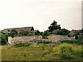
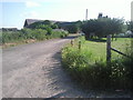
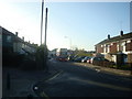
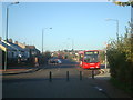


74 photos from this area
Area Information
Key information about the DA8 2DR including its size, population, and administrative classification.
- Area Type
- Postcode
- Area Size
- 4.8 hectares
- Population
- 1593
- Population Density
- 1029 people/km²
House Prices in DA8 2DR
62
Properties
£235,671
Average Sold Price
£58,500
Lowest Price
£378,000
Highest Price
Showing 62 properties
| Address | Type | Beds | Baths | Last Sale Price | Last Sale Date | |
|---|---|---|---|---|---|---|
| 102 Howbury Lane, Erith, DA8 2DR | Terraced | 3 | 1 | £370,000 | Mar 2025 | |
| 96 Howbury Lane, Erith, DA8 2DR | Terraced | 3 | 1 | £285,000 | Jul 2024 | |
| 106 Howbury Lane, Erith, DA8 2DR | Terraced | 3 | 1 | £340,000 | Jan 2024 | |
| 60 Howbury Lane, Erith, DA8 2DR | Retail | 3 | 1 | £378,000 | Nov 2022 | |
| 22 Howbury Lane, Erith, DA8 2DR | Semi-detached | 5 | - | £350,000 | Apr 2021 | |
| 36 Howbury Lane, Erith, DA8 2DR | house | - | - | £322,000 | Feb 2021 | |
| 8 Howbury Lane, Erith, DA8 2DR | Terraced | 3 | 1 | £245,000 | Sep 2020 | |
| 26 Howbury Lane, Erith, DA8 2DR | Semi-detached | 4 | 2 | £335,000 | Mar 2020 | |
| 58 Howbury Lane, Erith, DA8 2DR | house | 3 | 1 | £270,000 | Dec 2019 | |
| 114 Howbury Lane, Erith, DA8 2DR | house | 3 | 1 | £275,000 | Jun 2018 |
Page 1 of 7
Energy Efficiency in DA8 2DR
Amenities
Schools
| Rank | School | Type | Entry gender | Ages |
|---|
Explore more schools in this area
Go to Schools tabDemographics
Household Size
Family (3-5 people)
most common
Accommodation Type
Houses
most common
Tenure
30
majority
Ethnic Group
White
most common
Religion
N/A
most common
Household Composition
N/A
most common
Age
47
median
Adults (30-64 years)
most common
Household Deprivation
N/A
with no deprivation
NS-SEC
20
in Lower managerial occupations
Explore more demographic insights in this area
Go to Demographics tabPlanning
Planning Constraints
- Flood RiskPremium
- Ramsar Wetland SitesPremium
- Area of Outstanding Natural BeautyPremium
- Protected Nature ReservePremium
- Protected WoodlandPremium