Area Overview for DA8 2BT
Photos of DA8 2BT
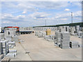
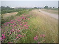
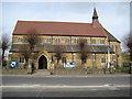
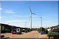
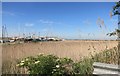
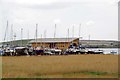
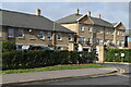
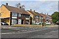
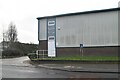
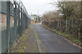
52 photos from this area
Area Information
Key information about the DA8 2BT including its size, population, and administrative classification.
- Area Type
- Postcode
- Area Size
- 2.2 hectares
- Population
- 1768
- Population Density
- 7520 people/km²
House Prices in DA8 2BT
79
Properties
£324,314
Average Sold Price
£100,625
Lowest Price
£460,000
Highest Price
Showing 79 properties
| Address | Type | Beds | Baths | Last Sale Price | Last Sale Date | |
|---|---|---|---|---|---|---|
| 37 Rainbow Road, Erith, DA8 2BT | Retail | 3 | 2 | £415,000 | Mar 2022 | |
| 17 Rainbow Road, Erith, DA8 2BT | house | - | - | £186,750 | Mar 2022 | |
| 87 Rainbow Road, Erith, DA8 2BT | house | - | - | £410,000 | Nov 2021 | |
| 43 Rainbow Road, Erith, DA8 2BT | Terraced | 2 | - | £355,000 | Aug 2021 | |
| 83 Rainbow Road, Erith, DA8 2BT | house | - | - | £456,000 | Aug 2021 | |
| 81 Rainbow Road, Erith, DA8 2BT | house | - | - | £460,000 | Jun 2021 | |
| 75 Rainbow Road, Erith, DA8 2BT | house | - | - | £425,000 | Mar 2021 | |
| 39 Rainbow Road, Erith, DA8 2BT | Terraced | 3 | 1 | £395,000 | Feb 2021 | |
| 33 Rainbow Road, Erith, DA8 2BT | Terraced | 3 | 2 | £400,000 | Sep 2020 | |
| 25 Rainbow Road, Erith, DA8 2BT | Terraced | 4 | 1 | £458,000 | Jan 2020 |
Page 1 of 8
Energy Efficiency in DA8 2BT
Amenities
Schools
| Rank | School | Type | Entry gender | Ages |
|---|
Explore more schools in this area
Go to Schools tabDemographics
Household Size
Family (3-5 people)
most common
Accommodation Type
Houses
most common
Tenure
74
majority
Ethnic Group
black_total
most common
Religion
N/A
most common
Household Composition
N/A
most common
Age
47
median
Adults (30-64 years)
most common
Household Deprivation
N/A
with no deprivation
NS-SEC
45
in Lower managerial occupations
Explore more demographic insights in this area
Go to Demographics tabPlanning
Planning Constraints
- Flood RiskPremium
- Ramsar Wetland SitesPremium
- Area of Outstanding Natural BeautyPremium
- Protected Nature ReservePremium
- Protected WoodlandPremium