Area Overview for DA8 1TB
Photos of DA8 1TB

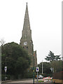
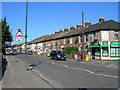
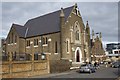
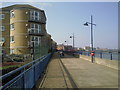

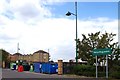
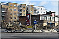
59 photos from this area
Area Information
Key information about the DA8 1TB including its size, population, and administrative classification.
- Area Type
- Postcode
- Area Size
- 6545 m²
- Population
- Not available
- Population Density
- Not available
House Prices in DA8 1TB
44
Properties
£164,459
Average Sold Price
£46,000
Lowest Price
£242,000
Highest Price
Showing 44 properties
| Address | Type | Beds | Baths | Last Sale Price | Last Sale Date | |
|---|---|---|---|---|---|---|
| 63 Pier Road, Erith, DA8 1TB | Flat | 2 | 2 | £242,000 | Nov 2024 | |
| 55 Pier Road, Erith, DA8 1TB | Flat | - | - | £215,000 | Jun 2023 | |
| 53 Pier Road, Erith, DA8 1TB | Flat | - | - | £228,000 | Jan 2023 | |
| 97 Pier Road, Erith, DA8 1TB | Flat | - | - | £220,000 | Apr 2022 | |
| 49 Pier Road, Erith, DA8 1TB | Flat | - | - | £230,500 | Mar 2022 | |
| 107 Pier Road, Erith, DA8 1TB | Maisonette | - | - | £217,750 | Nov 2020 | |
| 33 Pier Road, Erith, DA8 1TB | Maisonette | - | - | £214,000 | Dec 2018 | |
| 101 Pier Road, Erith, DA8 1TB | Flat | - | - | £225,000 | Nov 2016 | |
| 87 Pier Road, Erith, DA8 1TB | Flat | - | - | £240,000 | Oct 2016 | |
| 39 Pier Road, Erith, DA8 1TB | Flat | - | - | £225,000 | Sep 2016 |
Page 1 of 5
Energy Efficiency in DA8 1TB
Amenities
Schools
| Rank | School | Type | Entry gender | Ages |
|---|
Explore more schools in this area
Go to Schools tabDemographics
Household Size
One person
most common
Accommodation Type
Flats
most common
Tenure
45
majority
Ethnic Group
White
most common
Religion
N/A
most common
Household Composition
N/A
most common
Age
47
median
Adults (30-64 years)
most common
Household Deprivation
N/A
with no deprivation
NS-SEC
28
in Lower managerial occupations
Explore more demographic insights in this area
Go to Demographics tabPlanning
Planning Constraints
- Flood RiskPremium
- Ramsar Wetland SitesPremium
- Area of Outstanding Natural BeautyPremium
- Protected Nature ReservePremium
- Protected WoodlandPremium