Area Overview for DA8 1QE
Photos of DA8 1QE

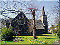
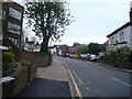
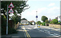
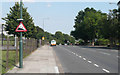

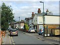


93 photos from this area
Area Information
Key information about the DA8 1QE including its size, population, and administrative classification.
- Area Type
- Postcode
- Area Size
- 1.9 hectares
- Population
- 1605
- Population Density
- 5146 people/km²
House Prices in DA8 1QE
51
Properties
£192,692
Average Sold Price
£68,500
Lowest Price
£362,500
Highest Price
Showing 51 properties
| Address | Type | Beds | Baths | Last Sale Price | Last Sale Date | |
|---|---|---|---|---|---|---|
| 270 Riverdale Road, Erith, DA8 1QE | Maisonette | 2 | 1 | £276,000 | Jul 2025 | |
| 260 Riverdale Road, Erith, DA8 1QE | Terraced | 3 | 1 | £362,500 | Oct 2024 | |
| 264 Riverdale Road, Erith, DA8 1QE | Maisonette | - | - | £283,000 | Jun 2024 | |
| 268 Riverdale Road, Erith, DA8 1QE | Maisonette | 2 | 1 | £277,500 | Jan 2023 | |
| 282 Riverdale Road, Erith, DA8 1QE | Maisonette | 2 | 1 | £195,000 | Jun 2019 | |
| 266 Riverdale Road, Erith, DA8 1QE | Maisonette | - | - | £225,000 | Aug 2018 | |
| 262 Riverdale Road, Erith, DA8 1QE | Maisonette | - | - | £221,000 | Mar 2016 | |
| 274 Riverdale Road, Erith, DA8 1QE | Terraced | - | - | £177,000 | Aug 2007 | |
| 280 Riverdale Road, Erith, DA8 1QE | Flat | - | - | £139,000 | Apr 2006 | |
| 288 Riverdale Road, Erith, DA8 1QE | Maisonette | 2 | 1 | £128,000 | Aug 2003 |
Page 1 of 6
Energy Efficiency in DA8 1QE
Amenities
Schools
| Rank | School | Type | Entry gender | Ages |
|---|
Explore more schools in this area
Go to Schools tabDemographics
Household Size
Family (3-5 people)
most common
Accommodation Type
Flats
most common
Tenure
51
majority
Ethnic Group
White
most common
Religion
N/A
most common
Household Composition
N/A
most common
Age
47
median
Adults (30-64 years)
most common
Household Deprivation
N/A
with no deprivation
NS-SEC
28
in Lower managerial occupations
Explore more demographic insights in this area
Go to Demographics tabPlanning
Planning Constraints
- Flood RiskPremium
- Ramsar Wetland SitesPremium
- Area of Outstanding Natural BeautyPremium
- Protected Nature ReservePremium
- Protected WoodlandPremium