Area Overview for DA8 1PU
Photos of DA8 1PU
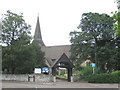
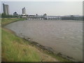
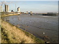
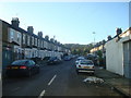
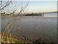


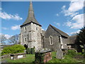
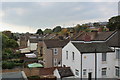
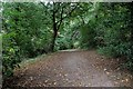
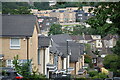
65 photos from this area
Area Information
Key information about the DA8 1PU including its size, population, and administrative classification.
- Area Type
- Postcode
- Area Size
- 8643 m²
- Population
- 2144
- Population Density
- 5001 people/km²
House Prices in DA8 1PU
60
Properties
£177,631
Average Sold Price
£11,000
Lowest Price
£395,000
Highest Price
Showing 60 properties
| Address | Type | Beds | Baths | Last Sale Price | Last Sale Date | |
|---|---|---|---|---|---|---|
| 19 Riverdale Road, Erith, DA8 1PU | Terraced | 3 | 1 | £375,000 | Mar 2025 | |
| 89 Riverdale Road, Erith, DA8 1PU | Terraced | 3 | 1 | £395,000 | Mar 2025 | |
| 57 Riverdale Road, Erith, DA8 1PU | Terraced | 4 | 1 | £375,000 | Aug 2024 | |
| 81A Riverdale Road, Erith, DA8 1PU | Flat | - | - | £195,000 | Sep 2021 | |
| 49 Riverdale Road, Erith, DA8 1PU | Flat | 1 | 1 | £180,000 | Jun 2020 | |
| 61 Riverdale Road, Erith, DA8 1PU | Terraced | 3 | 2 | £300,000 | Mar 2020 | |
| 41 Riverdale Road, Erith, DA8 1PU | Terraced | 3 | 1 | £272,500 | Aug 2019 | |
| 85A Riverdale Road, Erith, DA8 1PU | Flat | - | - | £184,000 | Mar 2019 | |
| 59 Riverdale Road, Erith, DA8 1PU | Terraced | 3 | 1 | £313,000 | Aug 2018 | |
| 71 Riverdale Road, Erith, DA8 1PU | Terraced | 3 | 1 | £320,000 | Aug 2017 |
Page 1 of 6
Energy Efficiency in DA8 1PU
Amenities
Schools
| Rank | School | Type | Entry gender | Ages |
|---|
Explore more schools in this area
Go to Schools tabDemographics
Household Size
Family (3-5 people)
most common
Accommodation Type
Houses
most common
Tenure
67
majority
Ethnic Group
White
most common
Religion
N/A
most common
Household Composition
N/A
most common
Age
47
median
Adults (30-64 years)
most common
Household Deprivation
N/A
with no deprivation
NS-SEC
31
in Lower managerial occupations
Explore more demographic insights in this area
Go to Demographics tabPlanning
Planning Constraints
- Flood RiskPremium
- Ramsar Wetland SitesPremium
- Area of Outstanding Natural BeautyPremium
- Protected Nature ReservePremium
- Protected WoodlandPremium