Area Overview for DA8 1DS
Photos of DA8 1DS

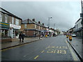


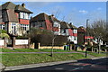
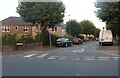

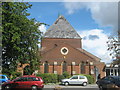
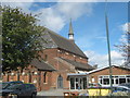
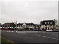
30 photos from this area
Area Information
Key information about the DA8 1DS including its size, population, and administrative classification.
- Area Type
- Postcode
- Area Size
- 6044 m²
- Population
- Not available
- Population Density
- Not available
House Prices in DA8 1DS
19
Properties
£196,227
Average Sold Price
£51,000
Lowest Price
£345,000
Highest Price
Showing 19 properties
| Address | Type | Beds | Baths | Last Sale Price | Last Sale Date | |
|---|---|---|---|---|---|---|
| 64 Carlton Road, Erith, DA8 1DS | Flat | 2 | 1 | £245,000 | Aug 2025 | |
| 78 Carlton Road, Erith, DA8 1DS | Flat | - | - | £220,000 | Jun 2021 | |
| 68 Carlton Road, Erith, DA8 1DS | Flat | 2 | 1 | £205,000 | Jul 2020 | |
| 54 Carlton Road, Erith, DA8 1DS | Semi-detached | 2 | 1 | £345,000 | Jul 2017 | |
| 60 Carlton Road, Erith, DA8 1DS | Maisonette | - | - | £195,000 | Jun 2016 | |
| 74 Carlton Road, Erith, DA8 1DS | Maisonette | 2 | 1 | £175,000 | Sep 2014 | |
| 70 Carlton Road, Erith, DA8 1DS | Maisonette | 2 | 1 | £132,000 | Aug 2012 | |
| 50 Carlton Road, Erith, DA8 1DS | Bungalow | 2 | - | £247,000 | Feb 2011 | |
| 58 Carlton Road, Erith, DA8 1DS | Maisonette | - | - | £133,500 | Dec 2010 | |
| 52 Carlton Road, Erith, DA8 1DS | Semi-detached | 3 | 1 | £210,000 | Jun 2009 |
Page 1 of 2
Energy Efficiency in DA8 1DS
Amenities
Schools
| Rank | School | Type | Entry gender | Ages |
|---|
Explore more schools in this area
Go to Schools tabDemographics
Household Size
Family (3-5 people)
most common
Accommodation Type
Houses
most common
Tenure
77
majority
Ethnic Group
White
most common
Religion
N/A
most common
Household Composition
N/A
most common
Age
47
median
Adults (30-64 years)
most common
Household Deprivation
N/A
with no deprivation
NS-SEC
37
in Lower managerial occupations
Explore more demographic insights in this area
Go to Demographics tabPlanning
Planning Constraints
- Flood RiskPremium
- Ramsar Wetland SitesPremium
- Area of Outstanding Natural BeautyPremium
- Protected Nature ReservePremium
- Protected WoodlandPremium