Area Overview for DA8 1BW
Photos of DA8 1BW
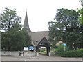
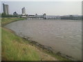
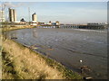
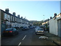
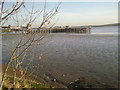


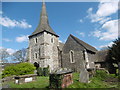
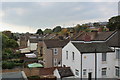
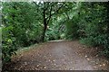
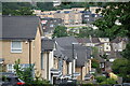
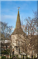
65 photos from this area
Area Information
Key information about the DA8 1BW including its size, population, and administrative classification.
- Area Type
- Postcode
- Area Size
- 4873 m²
- Population
- 1576
- Population Density
- 4120 people/km²
House Prices in DA8 1BW
16
Properties
£209,666
Average Sold Price
£129,995
Lowest Price
£350,000
Highest Price
Showing 16 properties
| Address | Type | Beds | Baths | Last Sale Price | Last Sale Date | |
|---|---|---|---|---|---|---|
| 4 Pembroke Road, Erith, DA8 1BW | Terraced | 2 | 3 | £350,000 | Oct 2023 | |
| 28 Pembroke Road, Erith, DA8 1BW | Semi-detached | 2 | 1 | £290,000 | Oct 2023 | |
| 18 Pembroke Road, Erith, DA8 1BW | Terraced | 2 | 1 | £242,000 | Jul 2019 | |
| 22 Pembroke Road, Erith, DA8 1BW | Terraced | 2 | 1 | £215,000 | Mar 2019 | |
| 14 Pembroke Road, Erith, DA8 1BW | Terraced | 2 | - | £250,000 | Nov 2016 | |
| 16 Pembroke Road, Erith, DA8 1BW | Terraced | 2 | - | £257,000 | Nov 2016 | |
| 20 Pembroke Road, Erith, DA8 1BW | Terraced | 2 | 1 | £142,000 | Nov 2011 | |
| 8 Pembroke Road, Erith, DA8 1BW | house | - | - | £180,000 | Jul 2011 | |
| 24 Pembroke Road, Erith, DA8 1BW | house | - | - | £130,000 | May 2009 | |
| 26 Pembroke Road, Erith, DA8 1BW | house | 2 | - | £175,000 | Sep 2007 |
Page 1 of 2
Energy Efficiency in DA8 1BW
Amenities
Schools
| Rank | School | Type | Entry gender | Ages |
|---|
Explore more schools in this area
Go to Schools tabDemographics
Household Size
Family (3-5 people)
most common
Accommodation Type
Houses
most common
Tenure
60
majority
Ethnic Group
White
most common
Religion
N/A
most common
Household Composition
N/A
most common
Age
47
median
Adults (30-64 years)
most common
Household Deprivation
N/A
with no deprivation
NS-SEC
28
in Lower managerial occupations
Explore more demographic insights in this area
Go to Demographics tabPlanning
Planning Constraints
- Flood RiskPremium
- Ramsar Wetland SitesPremium
- Area of Outstanding Natural BeautyPremium
- Protected Nature ReservePremium
- Protected WoodlandPremium