Area Overview for DA7 6RR
Photos of DA7 6RR
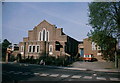
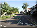
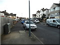
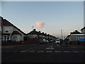
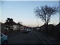
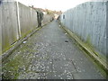
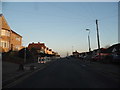
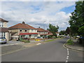
31 photos from this area
Area Information
Key information about the DA7 6RR including its size, population, and administrative classification.
- Area Type
- Postcode
- Area Size
- 1.1 hectares
- Population
- 1727
- Population Density
- 6490 people/km²
House Prices in DA7 6RR
24
Properties
£319,964
Average Sold Price
£112,500
Lowest Price
£590,000
Highest Price
Showing 24 properties
| Address | Type | Beds | Baths | Last Sale Price | Last Sale Date | |
|---|---|---|---|---|---|---|
| 74 Downbank Avenue, Bexleyheath, DA7 6RR | Bungalow | 2 | 1 | £428,000 | Feb 2025 | |
| 96 Downbank Avenue, Bexleyheath, DA7 6RR | Bungalow | 3 | - | £590,000 | Feb 2023 | |
| 78 Downbank Avenue, Bexleyheath, DA7 6RR | Semi-detached | 2 | - | £421,000 | Mar 2021 | |
| 56 Downbank Avenue, Bexleyheath, DA7 6RR | Semi-detached | 3 | 1 | £378,000 | Feb 2018 | |
| 58 Downbank Avenue, Bexleyheath, DA7 6RR | Bungalow | 2 | - | £292,000 | Dec 2015 | |
| 88 Downbank Avenue, Bexleyheath, DA7 6RR | Semi-detached | 5 | - | £380,000 | Oct 2015 | |
| 54 Downbank Avenue, Bexleyheath, DA7 6RR | Semi-detached | 3 | - | £303,000 | Aug 2015 | |
| 94 Downbank Avenue, Bexleyheath, DA7 6RR | Bungalow | 2 | - | £317,000 | Jan 2015 | |
| 80 Downbank Avenue, Bexleyheath, DA7 6RR | Bungalow | 3 | - | £315,000 | Sep 2013 | |
| 70 Downbank Avenue, Bexleyheath, DA7 6RR | Maisonette | 3 | - | £236,000 | Feb 2013 |
Page 1 of 3
Energy Efficiency in DA7 6RR
Amenities
Schools
| Rank | School | Type | Entry gender | Ages |
|---|
Explore more schools in this area
Go to Schools tabDemographics
Household Size
Family (3-5 people)
most common
Accommodation Type
Houses
most common
Tenure
83
majority
Ethnic Group
White
most common
Religion
N/A
most common
Household Composition
N/A
most common
Age
47
median
Adults (30-64 years)
most common
Household Deprivation
N/A
with no deprivation
NS-SEC
31
in Lower managerial occupations
Explore more demographic insights in this area
Go to Demographics tabPlanning
Planning Constraints
- Flood RiskPremium
- Ramsar Wetland SitesPremium
- Area of Outstanding Natural BeautyPremium
- Protected Nature ReservePremium
- Protected WoodlandPremium