Area Overview for DA7 6RB
Photos of DA7 6RB
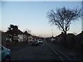
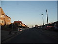
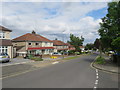
31 photos from this area
Area Information
Key information about the DA7 6RB including its size, population, and administrative classification.
- Area Type
- Postcode
- Area Size
- 2.2 hectares
- Population
- 1620
- Population Density
- 6998 people/km²
House Prices in DA7 6RB
36
Properties
£268,580
Average Sold Price
£63,000
Lowest Price
£555,000
Highest Price
Showing 36 properties
| Address | Type | Beds | Baths | Last Sale Price | Last Sale Date | |
|---|---|---|---|---|---|---|
| 54 Eversley Avenue, Bexleyheath, DA7 6RB | Bungalow | 2 | 1 | £400,000 | Jun 2025 | |
| 24 Eversley Avenue, Bexleyheath, DA7 6RB | Semi-detached | 3 | 1 | £540,000 | Dec 2023 | |
| 36 Eversley Avenue, Bexleyheath, DA7 6RB | Bungalow | 2 | 1 | £465,995 | Dec 2022 | |
| 64 Eversley Avenue, Bexleyheath, DA7 6RB | Retail | 2 | 1 | £365,000 | Aug 2022 | |
| 60 Eversley Avenue, Bexleyheath, DA7 6RB | house | - | - | £555,000 | Sep 2021 | |
| 14 Eversley Avenue, Bexleyheath, DA7 6RB | house | - | - | £325,000 | Feb 2021 | |
| 48 Eversley Avenue, Bexleyheath, DA7 6RB | Bungalow | - | - | £295,000 | Jun 2020 | |
| 38 Eversley Avenue, Bexleyheath, DA7 6RB | Semi-detached | 2 | 1 | £415,000 | Jun 2018 | |
| 46 Eversley Avenue, Bexleyheath, DA7 6RB | Semi-detached | - | - | £260,000 | Nov 2016 | |
| 16 Eversley Avenue, Bexleyheath, DA7 6RB | Semi-detached | 2 | - | £277,000 | Aug 2015 |
Page 1 of 4
Energy Efficiency in DA7 6RB
Amenities
Schools
| Rank | School | Type | Entry gender | Ages |
|---|
Explore more schools in this area
Go to Schools tabDemographics
Household Size
Family (3-5 people)
most common
Accommodation Type
Houses
most common
Tenure
84
majority
Ethnic Group
White
most common
Religion
N/A
most common
Household Composition
N/A
most common
Age
47
median
Adults (30-64 years)
most common
Household Deprivation
N/A
with no deprivation
NS-SEC
36
in Lower managerial occupations
Explore more demographic insights in this area
Go to Demographics tabPlanning
Planning Constraints
- Flood RiskPremium
- Ramsar Wetland SitesPremium
- Area of Outstanding Natural BeautyPremium
- Protected Nature ReservePremium
- Protected WoodlandPremium