Area Overview for DA7 6NW
Photos of DA7 6NW

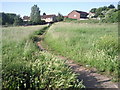

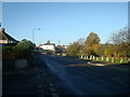


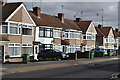


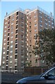
32 photos from this area
Area Information
Key information about the DA7 6NW including its size, population, and administrative classification.
- Area Type
- Postcode
- Area Size
- 7429 m²
- Population
- 1381
- Population Density
- 5053 people/km²
House Prices in DA7 6NW
27
Properties
£276,962
Average Sold Price
£103,000
Lowest Price
£485,000
Highest Price
Showing 27 properties
| Address | Type | Beds | Baths | Last Sale Price | Last Sale Date | |
|---|---|---|---|---|---|---|
| 178 Parkside Avenue, Bexleyheath, DA7 6NW | Terraced | 4 | 1 | £485,000 | Aug 2025 | |
| 180 Parkside Avenue, Bexleyheath, DA7 6NW | Terraced | 3 | 1 | £420,000 | Feb 2023 | |
| 162 Parkside Avenue, Bexleyheath, DA7 6NW | Terraced | 3 | 1 | £382,000 | Nov 2021 | |
| 156 Parkside Avenue, Bexleyheath, DA7 6NW | Terraced | 3 | - | £345,000 | Jan 2021 | |
| 202 Parkside Avenue, Bexleyheath, DA7 6NW | Terraced | 3 | 1 | £445,000 | Dec 2020 | |
| 188 Parkside Avenue, Bexleyheath, DA7 6NW | Terraced | 3 | 1 | £410,000 | Jun 2020 | |
| 182 Parkside Avenue, Bexleyheath, DA7 6NW | Terraced | 3 | - | £315,000 | Oct 2019 | |
| 198 Parkside Avenue, Bexleyheath, DA7 6NW | Terraced | 3 | 1 | £315,000 | Mar 2018 | |
| 172 Parkside Avenue, Bexleyheath, DA7 6NW | Terraced | 3 | 1 | £300,000 | Feb 2016 | |
| 158 Parkside Avenue, Bexleyheath, DA7 6NW | Terraced | 3 | 1 | £267,000 | Mar 2015 |
Page 1 of 3
Energy Efficiency in DA7 6NW
Amenities
Schools
| Rank | School | Type | Entry gender | Ages |
|---|
Explore more schools in this area
Go to Schools tabDemographics
Household Size
Family (3-5 people)
most common
Accommodation Type
Houses
most common
Tenure
80
majority
Ethnic Group
White
most common
Religion
N/A
most common
Household Composition
N/A
most common
Age
47
median
Adults (30-64 years)
most common
Household Deprivation
N/A
with no deprivation
NS-SEC
37
in Lower managerial occupations
Explore more demographic insights in this area
Go to Demographics tabPlanning
Planning Constraints
- Flood RiskPremium
- Ramsar Wetland SitesPremium
- Area of Outstanding Natural BeautyPremium
- Protected Nature ReservePremium
- Protected WoodlandPremium