Area Overview for DA7 6ET
Photos of DA7 6ET

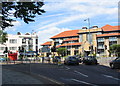
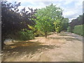
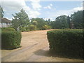


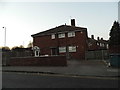
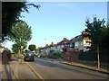
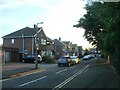
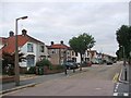
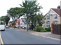
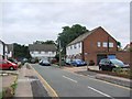
67 photos from this area
Area Information
Key information about the DA7 6ET including its size, population, and administrative classification.
- Area Type
- Postcode
- Area Size
- 1.2 hectares
- Population
- 1695
- Population Density
- 3523 people/km²
House Prices in DA7 6ET
36
Properties
£350,691
Average Sold Price
£243,745
Lowest Price
£590,000
Highest Price
Showing 36 properties
| Address | Type | Beds | Baths | Last Sale Price | Last Sale Date | |
|---|---|---|---|---|---|---|
| 17 Sterling Road, Bexleyheath, DA7 6ET | house | - | - | £505,000 | Jul 2024 | |
| 18 Sterling Road, Bexleyheath, DA7 6ET | Terraced | 3 | 2 | £455,000 | Jul 2023 | |
| 30 Sterling Road, Bexleyheath, DA7 6ET | house | - | - | £540,000 | Dec 2020 | |
| 3 Sterling Road, Bexleyheath, DA7 6ET | Terraced | 2 | 3 | £404,000 | Nov 2020 | |
| 10 Sterling Road, Bexleyheath, DA7 6ET | house | - | - | £450,000 | Jun 2019 | |
| 22 Sterling Road, Bexleyheath, DA7 6ET | Terraced | 2 | 2 | £390,000 | Dec 2018 | |
| 1 Sterling Road, Bexleyheath, DA7 6ET | Detached | 4 | 3 | £590,000 | Apr 2018 | |
| 28 Sterling Road, Bexleyheath, DA7 6ET | Semi-detached | 4 | 2 | £507,000 | Jul 2017 | |
| 7 Sterling Road, Bexleyheath, DA7 6ET | Terraced | 3 | - | £399,995 | Jun 2017 | |
| 2 Sterling Road, Bexleyheath, DA7 6ET | Terraced | 2 | 2 | £243,745 | Apr 2015 |
Page 1 of 4
Energy Efficiency in DA7 6ET
Amenities
Schools
| Rank | School | Type | Entry gender | Ages |
|---|
Explore more schools in this area
Go to Schools tabDemographics
Household Size
Family (3-5 people)
most common
Accommodation Type
Houses
most common
Tenure
70
majority
Ethnic Group
White
most common
Religion
N/A
most common
Household Composition
N/A
most common
Age
47
median
Adults (30-64 years)
most common
Household Deprivation
N/A
with no deprivation
NS-SEC
36
in Lower managerial occupations
Explore more demographic insights in this area
Go to Demographics tabPlanning
Planning Constraints
- Flood RiskPremium
- Ramsar Wetland SitesPremium
- Area of Outstanding Natural BeautyPremium
- Protected Nature ReservePremium
- Protected WoodlandPremium