Area Overview for DA7 6DD
Photos of DA7 6DD
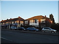

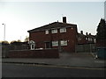
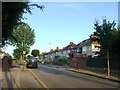
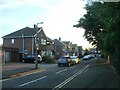
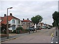
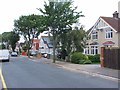
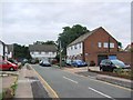
67 photos from this area
Area Information
Key information about the DA7 6DD including its size, population, and administrative classification.
- Area Type
- Postcode
- Area Size
- 1.7 hectares
- Population
- 1656
- Population Density
- 6492 people/km²
House Prices in DA7 6DD
38
Properties
£316,535
Average Sold Price
£94,000
Lowest Price
£585,000
Highest Price
Showing 38 properties
| Address | Type | Beds | Baths | Last Sale Price | Last Sale Date | |
|---|---|---|---|---|---|---|
| 54 Rudland Road, Bexleyheath, DA7 6DD | Bungalow | 2 | 1 | £410,000 | Feb 2025 | |
| 30 Rudland Road, Bexleyheath, DA7 6DD | Semi-detached | 2 | 1 | £455,000 | Apr 2024 | |
| 50 Rudland Road, Bexleyheath, DA7 6DD | Semi-detached | 2 | 2 | £504,000 | Jul 2023 | |
| 64 Rudland Road, Bexleyheath, DA7 6DD | Bungalow | 3 | 1 | £439,000 | Apr 2023 | |
| 2C Rudland Road, Bexleyheath, DA7 6DD | Semi-detached | 3 | 1 | £375,000 | Sep 2022 | |
| 14 Rudland Road, Bexleyheath, DA7 6DD | Bungalow | 4 | 2 | £540,000 | Jun 2022 | |
| 68 Rudland Road, Bexleyheath, DA7 6DD | Bungalow | 2 | - | £400,000 | Apr 2022 | |
| 36 Rudland Road, Bexleyheath, DA7 6DD | Bungalow | 4 | 2 | £585,000 | Apr 2021 | |
| 46 Rudland Road, Bexleyheath, DA7 6DD | Semi-detached | 2 | - | £385,000 | Sep 2020 | |
| 10 Rudland Road, Bexleyheath, DA7 6DD | Semi-detached | 3 | - | £335,000 | Nov 2018 |
Page 1 of 4
Energy Efficiency in DA7 6DD
Amenities
Schools
| Rank | School | Type | Entry gender | Ages |
|---|
Explore more schools in this area
Go to Schools tabDemographics
Household Size
One person
most common
Accommodation Type
Houses
most common
Tenure
65
majority
Ethnic Group
White
most common
Religion
N/A
most common
Household Composition
N/A
most common
Age
47
median
Adults (30-64 years)
most common
Household Deprivation
N/A
with no deprivation
NS-SEC
34
in Lower managerial occupations
Explore more demographic insights in this area
Go to Demographics tabPlanning
Planning Constraints
- Flood RiskPremium
- Ramsar Wetland SitesPremium
- Area of Outstanding Natural BeautyPremium
- Protected Nature ReservePremium
- Protected WoodlandPremium