Area Overview for DA7 5RB
Photos of DA7 5RB


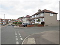
59 photos from this area
Area Information
Key information about the DA7 5RB including its size, population, and administrative classification.
- Area Type
- Postcode
- Area Size
- 1.3 hectares
- Population
- Not available
- Population Density
- Not available
House Prices in DA7 5RB
28
Properties
£325,456
Average Sold Price
£109,000
Lowest Price
£550,000
Highest Price
Showing 28 properties
| Address | Type | Beds | Baths | Last Sale Price | Last Sale Date | |
|---|---|---|---|---|---|---|
| 163 King Harolds Way, Bexleyheath, DA7 5RB | Semi-detached | 2 | 1 | £462,500 | Mar 2025 | |
| 121 King Harolds Way, Bexleyheath, DA7 5RB | Bungalow | 2 | 1 | £448,000 | Oct 2024 | |
| 149 King Harolds Way, Bexleyheath, DA7 5RB | Bungalow | 2 | 1 | £450,000 | Nov 2023 | |
| 133 King Harolds Way, Bexleyheath, DA7 5RB | Retail | 2 | 2 | £460,000 | May 2022 | |
| 169 King Harolds Way, Bexleyheath, DA7 5RB | Detached | 4 | 2 | £550,000 | Aug 2020 | |
| 119 King Harolds Way, Bexleyheath, DA7 5RB | Semi-detached | 2 | 1 | £425,000 | Aug 2020 | |
| 131 King Harolds Way, Bexleyheath, DA7 5RB | Bungalow | 3 | 1 | £370,000 | Aug 2019 | |
| 157 King Harolds Way, Bexleyheath, DA7 5RB | Bungalow | - | - | £320,000 | May 2019 | |
| 159 King Harolds Way, Bexleyheath, DA7 5RB | Bungalow | 2 | 1 | £325,000 | Mar 2017 | |
| 165 King Harolds Way, Bexleyheath, DA7 5RB | Semi-detached | 2 | - | £385,000 | Feb 2017 |
Page 1 of 3
Energy Efficiency in DA7 5RB
Amenities
Schools
| Rank | School | Type | Entry gender | Ages |
|---|
Explore more schools in this area
Go to Schools tabDemographics
Household Size
Family (3-5 people)
most common
Accommodation Type
Houses
most common
Tenure
93
majority
Ethnic Group
White
most common
Religion
N/A
most common
Household Composition
N/A
most common
Age
47
median
Adults (30-64 years)
most common
Household Deprivation
N/A
with no deprivation
NS-SEC
36
in Lower managerial occupations
Explore more demographic insights in this area
Go to Demographics tabPlanning
Planning Constraints
- Flood RiskPremium
- Ramsar Wetland SitesPremium
- Area of Outstanding Natural BeautyPremium
- Protected Nature ReservePremium
- Protected WoodlandPremium